处理不断增长的数据集
利用人工智能在地理空间行业的力量:处理不断增长的数据集

gis,openlayers,leaflet,gis应用,geoai,geoserver,cesium,python,arcpy,arcmap,webgis,gis可视化
利用人工智能在地理空间行业的力量:处理不断增长的数据集
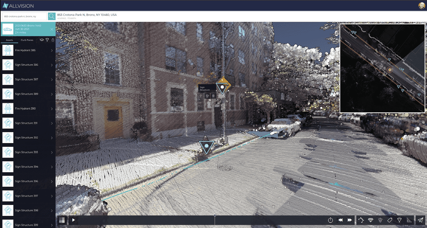
随着地理空间行业在技术方面取得显著进展,人工智能图像识别已经成为一种强大的工具,有潜力改变我们提取、分析和解释地理空间数据的方式。通过自动识别和分类卫星影像和激光雷达数据中的对象和特征,人工智能图像识别在城市规划、环境监测、灾害管理等应用中具有潜力。然而,尽管这些功能令人印象深刻,但我们必须认识到存在的限制和挑战,这些限制和挑战阻碍了这些技术实现真正无所不知的能力。在这里,我们要区分现实和科幻。人工智能的当前状态是什么,什么是可能的和不可能的?
– 无需翻墙,只要能上网就可以访问
– 支持PC、手机、微信、只要有浏览器就可以
– 内置了角色模块;预制助手充当的各种角色;根据需要直接选择对应角色可以更准确的回答你的问题。
还支持自定义角色,让您的助手更智能。

水文监测与预警是保障水资源管理和防灾减灾的重要工作。随着地理信息系统(Geographic Information System,简称GIS)技术的发展,其在水文领域的应用越来越广泛。GIS可以用于收集、存储和分析水文数据,包括降雨量、水位、流量等信息。通过空间分析和模型建立,可以实现水文监测和预警系统,提供及时的洪水预警、旱情监测等功能。本文将从技术角度详细介绍水文监测与预警平台的搭建,并结合真实案例进行说明。
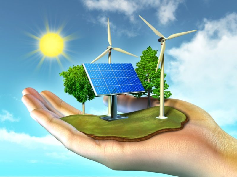
可再生能源是指能够自行再生或通过自然过程不断更新的能源,如太阳能、风能、水能、地热能等。随着对气候变化和能源安全的关注不断增加,可再生能源在电力系统规划与管理中的应用变得越来越重要。
GIS(地理信息系统)是近年来矿产资源开发与管理系统中广泛应用的一种技术工具。GIS将地理空间信息与属性信息结合起来,以地图形式进行数据的显示、管理、分析和处理,可以为矿产资源的开发提供有力的支持。本文将介绍GIS在矿产资源开发与管理系统中的应用,以及其使用的目的和优势。

data:存储 GeoServer 的工作空间、图层、样式、数据存储等配置信息;
logs:存储 GeoServer 的日志文件;
security:存储 GeoServer 的安全配置信息;
styles:存储 GeoServer 的样式配置信息;
wms:存储 GeoServer 的 WMS 相关配置信息。

上个月,Cesium宣布与Google Maps Platform建立了新的合作伙伴关系,后者将使用前者的3D Tiles通过其Maps API渲染其新的真实感3D Tiles。Cesium的3D Tiles是开放地理空间联盟(OGC)的3D Tiles标准,现在将与Google Maps Platform的庞大数据集一起使用,该数据集覆盖了2500多个城市和49个国家。

抱歉,以下是120字以内的总结简介:
第20届GEOINT研讨会聚集了政府、学术界和私营企业的GEOINT社区,探讨了新技术和劳动力变化对地理空间情报的影响。私营企业在面临新技术和不断变化的劳动力时,需要不断适应和创新。虽然地理空间情报界主要以太空为基础,但他们面临的挑战与整个地理空间行业的许多其他方面是平行的。

以色列的国家公路公司正在着手实施一项大规模的多年期项目,以将其整个网络数字化。测量公司 Kav Medida 已获得使用先进的 GIS 软件、无人机和 360° 移动测绘相机绘制网络北半部地图的合同。由此产生的数字化地图将显着提高以色列道路维护和监测的准确性和效率,提供与灯杆臂长度、标志高度、交通标志方位角、沟渠类型和横截面深度相关的详细测量数据。本文详细介绍了如何捕获和利用地理空间数据,以及该公司如何实施创新解决方案来提高生产力,同时降低运营成本。

地理空间数字孪生为复杂系统提供无与伦比的清晰度

Vision Pro的应用场景非常广泛,从娱乐到教育,从医疗到工业,都可以利用它来创造出全新的体验和价值。但是,今天我想跟大家聊聊Vision Pro对于GIS(地理信息系统)行业的影响。
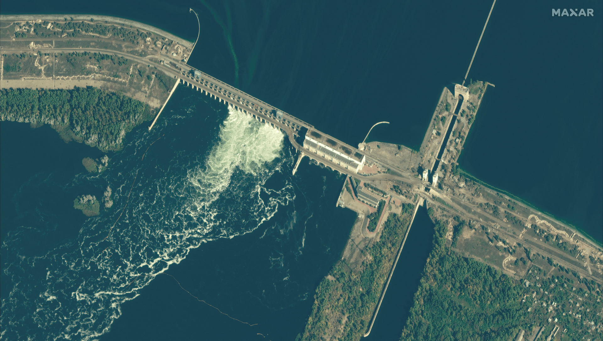
乌克兰卡霍夫卡水电站是欧洲最大的水电站之一,位于第聂伯河上,距离首都基辅约300公里。该水电站由四个单元组成,总装机容量为2256兆瓦,年发电量约为100亿千瓦时。该水电站不仅为乌克兰提供了大量的清洁能源,还具有调节河流流量、防止洪水、灌溉农田等多种功能。然而,由于乌克兰的政治动荡和安全威胁,该水电站的大坝遭到恐怖分子或敌对势力的袭击,导致大坝破裂,造成灾难性的后果。因此,提前制定一个有效的应急预案,以应对大坝被炸的可能性,是非常必要的。
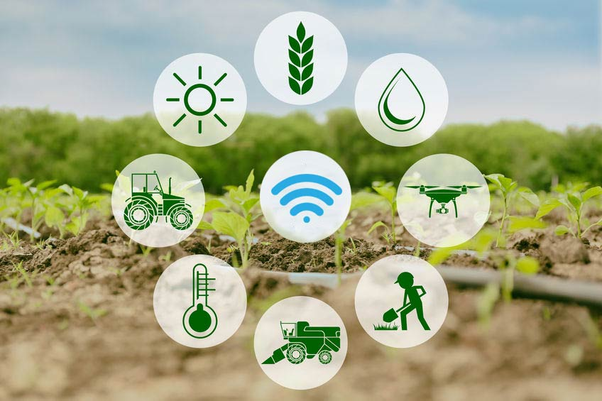
随着人口的增长、资源的匮乏,传统农业已经无法满足人们的需求。智慧农场以信息化、智能化、生态化和一体化为特点,通过引入先进的技术手段,实现了生产方式和生产效率的升级。本文将从定义、特点、技术应用和实际案例四个方面,介绍智慧农场的全貌。
随着科技的不断发展,遥感技术在农业领域得到了广泛的应用。遥感技术结合地面观测数据,可以用于估计土地土壤属性,如土壤类型、质地、含水量等。这对于土壤管理和农业生产具有重要意义,可以优化土壤施肥方案、提高农作物产量。
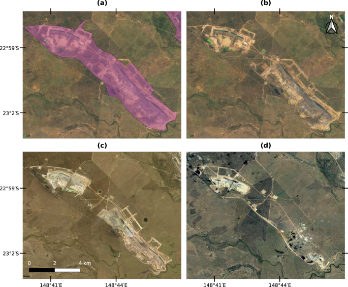
通过利用卫星和航空传感器获取的高分辨率影像数据,我们能够检测和监测土地面临的不同干扰因素,如采矿活动、土地退化和土地污染等。这种监测能够帮助我们及时发现土地资源面临的潜在问题,并制定相应的保护和修复措施。本文将详细介绍遥感技术在土地干扰监测中的应用,并结合真实案例加以说明。
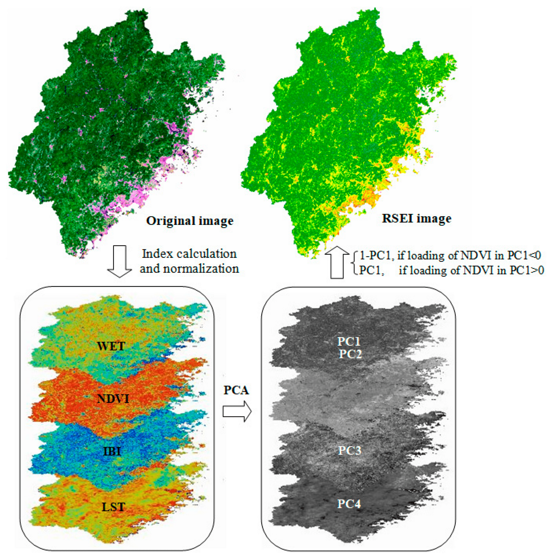
土地生态环境评价是保护和恢复生态系统功能的重要手段,它对于科学合理地规划土地利用、推动生态建设具有重要意义。遥感技术作为一种非接触式、广覆盖性的监测手段,能够获取大范围土地信息,并提供丰富的土地生态环境相关指标,如植被指数、土地蓄水能力等。利用遥感技术进行土地生态环境评价,能够全面客观地评估土地的生态环境质量,为生态保护和恢复提供科学依据。
本文将探讨遥感技术在土地变化监测中的应用。通过比较不同时间点的遥感影像,遥感技术能够帮助评估土地资源的可持续利用、检测非法占地行为,并为土地规划和管理提供决策支持。我们将详细介绍遥感技术在土地变化监测中的实现方式,并提供真实案例加以说明。
土地利用/覆盖分类是土地管理和规划的重要任务之一。遥感技术作为一种强大的工具,广泛应用于土地利用/覆盖分类中,通过获取和分析遥感影像数据,可以实现自动化的土地分类和监测。本文将详细介绍遥感在土地利用/覆盖分类中的应用,包括遥感数据获取、分类方法、实现方式以及相关的真实案例。
水文气象预报是防灾减灾工作中的重要组成部分,通过准确预测和及时发布水文气象信息,可以提前预警、采取有效的防灾减灾措施,减少灾害损失。本文旨在探讨水文气象预报在防灾减灾中的关键作用,介绍预报技术和方法,并通过真实案例展示其应用和效果。
最新OSM中国最新数据2023-5-30,china-latest.osm.pbf
土地利用变更调查与评估中,地理信息系统(GIS)和遥感技术是两个重要的工具,它们相互结合可以提供全面而准确的土地利用变更信息。以下将重点探讨GIS和遥感技术在土地利用变更调查与评估中的应用。
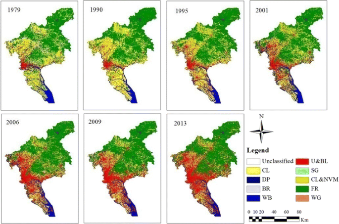
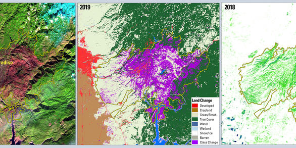
土地利用变更是指在原有土地利用类型的基础上,经过规划、开发、建设等过程,将土地的利用类型由一个或多个类型变更为另一个或多个类型。土地利用变更调查与评估是为了了解和评估土地利用变更对环境、经济和社会等方面的影响,以便为土地资源合理利用提供科学依据。本文将探讨土地利用变更的调查与评估方法,并结合实际案例进行分析。
超分辨率虽然在技术上没有提高数据的实际分辨率,但有可能显着提高卫星图像的视觉质量,有效地创建高清 (HD) 图像。在商业环境中,SR 已被用于将图像从 30cm 到 15cm 分辨率或 50cm 到 30cm 分辨率细化。有些人甚至冒险增强低分辨率开源数据,例如将 European Sentinel-2 10m 数据提高到令人印象深刻的 2.5m 分辨率。更重要的是,这种增强可以应用于所有光谱带。
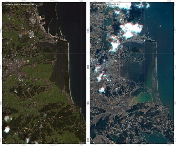
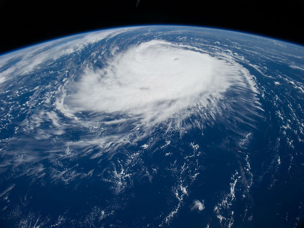
卫星成像技术的进步使人们有可能越来越多地了解自然灾害的影响。这主要归功于多时相卫星图像,它是灾害管理和降低风险的有力工具。多时相卫星图像结合了在不同时间拍摄的图像,以创建一个区域的更详细的图片。这些图像可以提供有关洪水、风暴、地震和山体滑坡等灾害影响的宝贵信息。

得克萨斯州弗里斯科市拥有公共安全事件和人员位置的实时地图,供警察、消防和交通部门共享。这张地图是一个公共安全数字双胞胎,延伸到学校内部,让响应者和工作人员能够看到走廊的实时视频。如果交通拥堵,运输工程师可以查看实时地图,他们可以远程更改交通信号。当事件发生时,消防和警察工作人员使用数字双胞胎来接听电话并协调响应。

最新全国省市县级shp数据; 字段:包括边界数据、行政区划名称、行政区划编码、地址、中心点坐标信息、附带层级关系 坐标系:WGS84(国家2000坐标系),无偏移 格式:shapefile
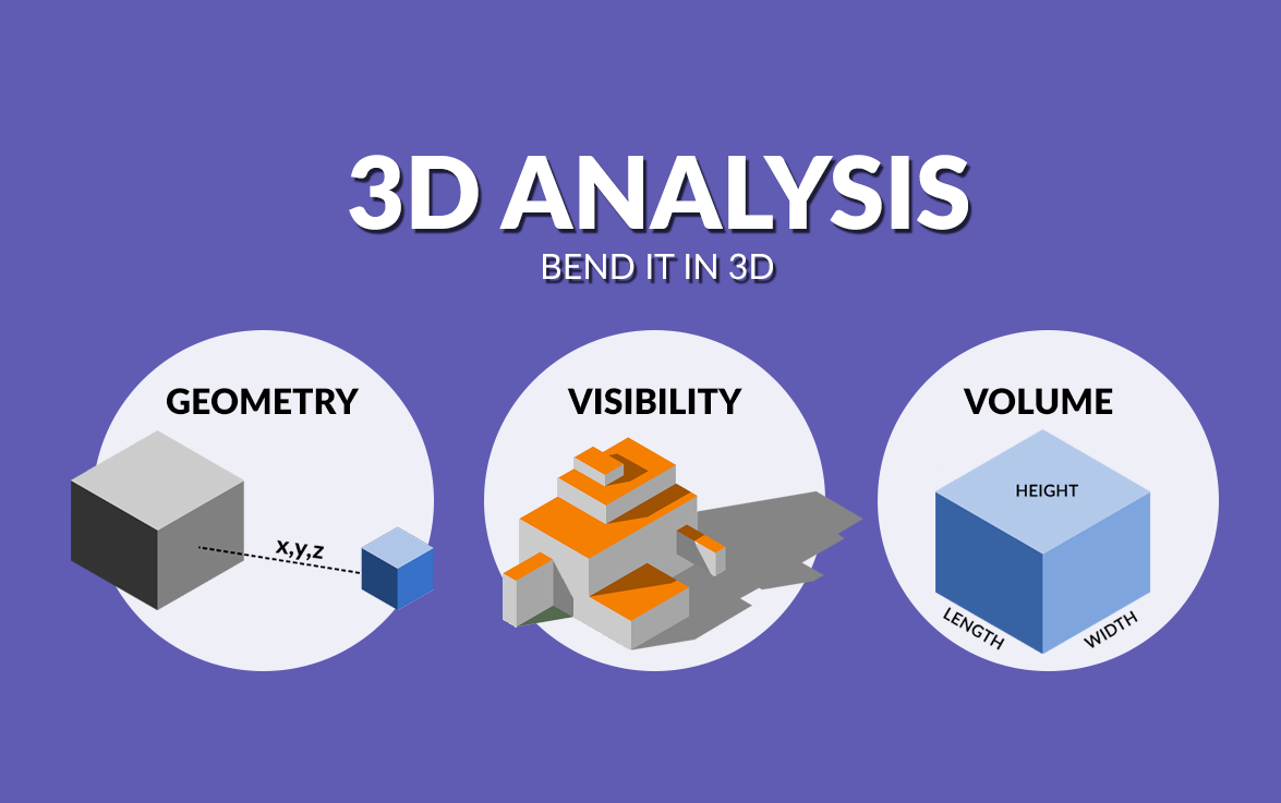
3D 分析一直是 GIS 中的增长趋势,因为它可以更好地表示现实世界。
这不仅仅是为了一张漂亮的照片。对于某些类型的问题,3D 分析有时是您解决它们的唯一方法。
推动这一需求的 3D 数据类型也呈爆炸式增长。例如,激光雷达、 BIM 、无人机、纹理网格、摄影测量、钻孔、物联网、增强现实、 InSAR 、时空立方体和室内映射都是 3D 数据的示例。
但是有什么样的工具可用?以下是 GIS 中一些常见的 3D 分析类型。
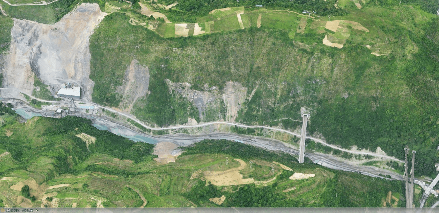
从无人机和卫星到机载传感器和激光雷达,遥感和地理空间信息科学的进步正在推动数据采集、处理和维护创新方法的发展。本文着眼于这些如何支持适合目的的土地管理。

关键要点
– 美国陆军工程兵团使用许多地理空间系统来维护通航港口和航道。
– 天气变化加剧了疏浚计划和执行的复杂性和需求。
– 军团建立了一个系统的系统,汇集了数据以显示航道状况的全貌。
密西西比河是美国最重要的内陆水道,它以最低的成本将基本商品运往市场,包括大部分出口谷物。这条大河水位的剧烈变化常常引起全国的关注和不确定性。但是,一个旨在监控和模拟河流行为和运行的新制作的数字孪生揭示了问题点。

在澳大利亚发展最快的城市布里斯班,数字孪生和虚拟现实程序指导地下铁路的设计和建设。
**关键要点**
– 在澳大利亚布里斯班,一个不断发展的数字孪生正在帮助团队设计和建造地下跨河铁路项目,这是该市的第一条地铁。
– 工程师和设计师使用一个中央存储库来整合与新隧道和车站相关的所有数据,并与上面城市的真实模型相结合。
– 游戏引擎将孪生转变为虚拟现实工具,以浏览设计、规划复杂的构造并交流进度。
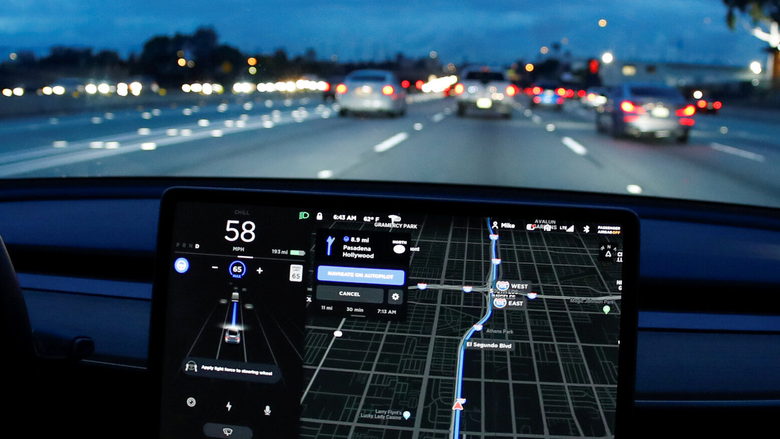
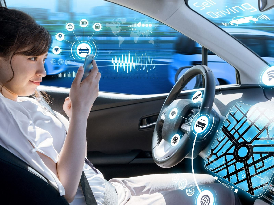
为了探讨自动驾驶与高精度定位的最优策略,我们邀请了某汽车集团的高级工程师、某自动驾驶研究团队的技术总监、某高精度定位公司的CEO、某领先计算机视觉技术企业的副总裁以及本领域的知名学者,进行了一次圆桌对话。

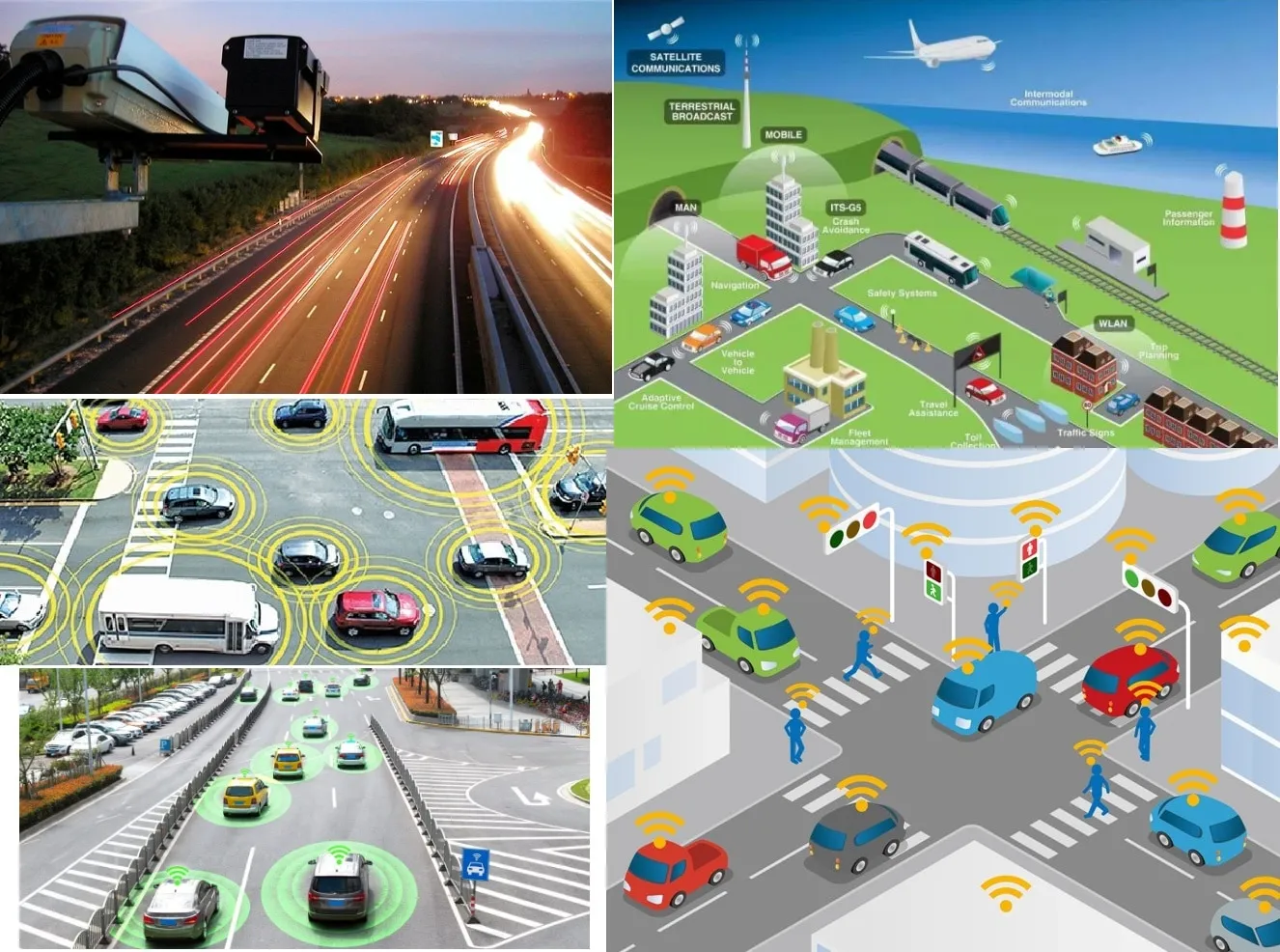
车路协同(V2X)指的是车辆和道路之间的信息交互,旨在提升交通安全、改善路况和减少碳排放。车辆可以通过V2X技术获得道路环境的状态,例如行车速度、道路状况和路口交通情况。同时,V2X技术可以使道路管理部门和交通管理中心实时监控和管理道路交通。

随着数字化的不断深入,数字世界已经不再只是简单的计算和数据管理,数字技术开始向更深层次的应用转变,涉及更多的方面,比如虚拟世界、针对人类特点的应用等等。元宇宙和ChatGPT作为数字世界的新兴技术,引起了越来越多人的关注。本文将深入剖析数字孪生与数字原生,探讨元宇宙和ChatGPT与数字技术的关系以及未来的发展趋势。
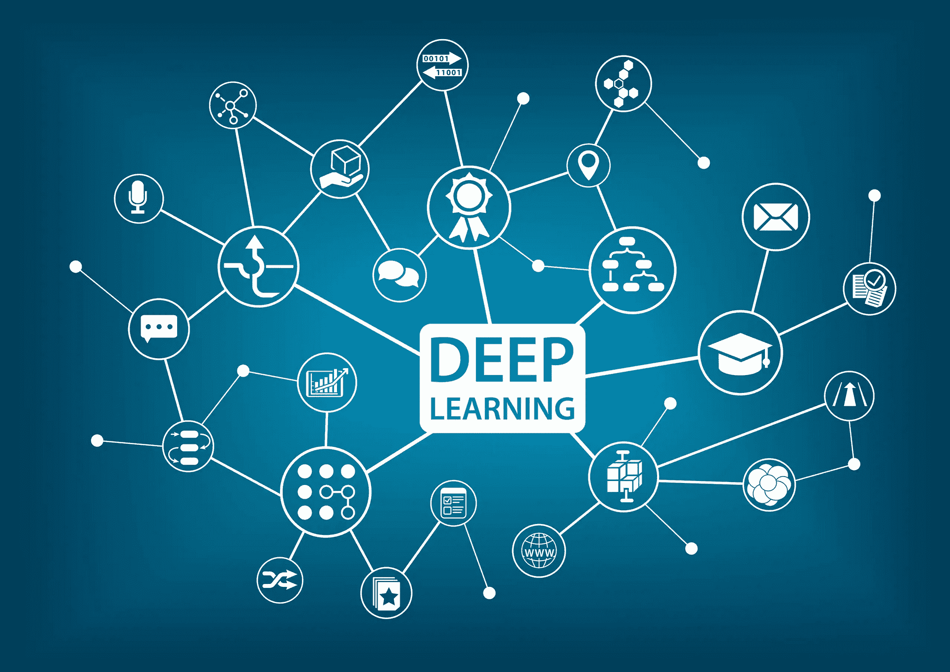
随着人工智能技术的不断发展,遥感技术也在向着更加智能化、高效化的方向发展。其中,AI遥感大模型成为了一种重要的技术手段,能够为遥感应用带来新的可能性。本文将介绍AI遥感大模型的基本概念、原理和应用。
数字孪生是指利用数字技术建立虚拟世界,通过对物理世界的实时监测、分析和模拟,实现对物理世界的精准管理和优化。数字孪生技术可以应用于多个领域,如智慧城市、智能制造、物联网等。本文将重点探讨数字孪生技术在智慧交通中的应用。

GeoServer是一个开源的地理空间数据服务器,它支持多种地理数据格式和协议,并提供了Web界面和REST API,使得数据发布和管理变得更加方便和易于实现。在本文中,我们将详细介绍如何在不同操作系统中安装、运行和升级GeoServer。
GeoServer是一个基于Java的Web应用程序,它可以将各种空间数据源转换为可视化的地图或图表,并通过多种标准的地理空间数据协议(例如WMS、WFS、WCS、WPS等)将这些数据发布到Web上。GeoServer能够在多种平台上运行,包括Windows、Linux和MacOS等操作系统,并且支持多种数据库作为后端数据存储。

数字孪生城市是当下城市发展的重要方向之一,通过数字技术与城市建设相结合,实现了城市运行的可视化、模拟、优化和智能化,为城市管理和规划提供了强有力的支撑。但是数字孪生城市的实现需要涉及到各种领域的技术和管理问题,如何实现数字孪生城市的进化是一个需要广泛探讨的话题。为此,我们邀请了几位数字孪生城市领域的专家进行了一场圆桌对话,从感知到决策,探讨数字孪生城市的进化之路。

地理信息系统(GIS)已经成为现代土地利用变更调查与评估中不可或缺的工具。GIS可以用来处理、分析和可视化各种空间数据和属性数据,通过数据的处理和分析,为评估提供科学依据,同时为制定土地利用政策和管理措施提供支持。本文将详细介绍GIS在土地利用变更调查与评估中的应用,重点关注业务痛点和创造性解决方案。
地质灾害是自然界造成的人类社会不可避免的灾害之一,其发生对人类的生命财产安全都造成了巨大的威胁。为了降低地质灾害给人类社会带来的影响,需要对其风险进行评估和管理。本文将从什么是地质灾害、地质灾害的评估方法、地质灾害的管理等方面展开探讨。

在电力行业中,GIS可以应用于多个场景,包括电网规划、运行管理、设备监测和维护等方面。本文将重点探讨电力GIS的应用场景及其实际效益
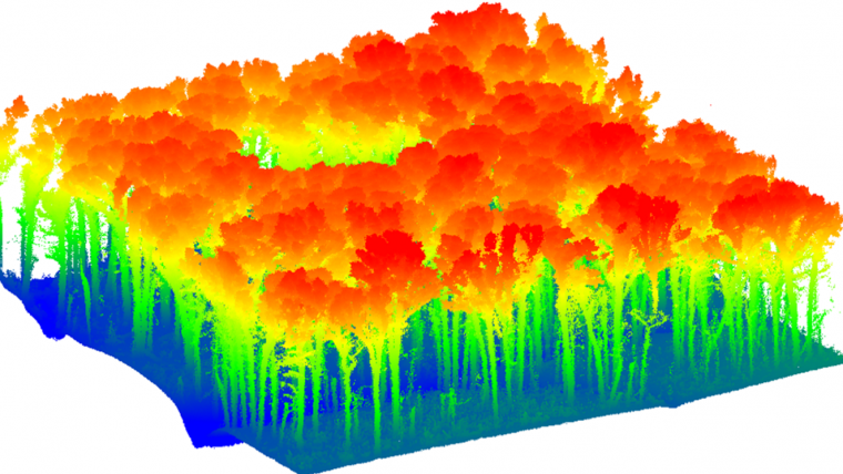
为了支持数据驱动的政策和管理实践,迫切需要快速、严格、可重复和可扩展的森林清查工具,以应对森林砍伐和气候变化等挑战。传统上,这些清单是手动进行的,既昂贵又耗时。随着传感器和算法技术的进步,近远距离传感器和平台,如激光雷达、TLS和地面移动激光雷达等,提供了各种规模的自动森林清查的替代方案。然而,每个平台都存在成本、效率、覆盖范围、分辨率等方面的权衡。因此,需要综合考虑这些因素来选择最佳方案,以支持全球森林可持续性的六项目标的实现。
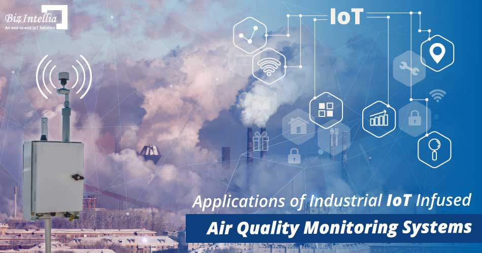
随着经济和人口的增长,全球的大气环境污染问题变得越来越严重。为了有效地监测和控制大气环境污染,GIS技术被广泛应用于空气质量监测、气象监测、火灾监测和污染源监测等方面。本文将介绍GIS在这些领域的应用,以及相关的案例和技术
随着全球气候变化、人口增长和城市化的加速,水资源管理成为当今社会面临的重要挑战之一。在过去,人们更多地依赖于经验和感性决策,但随着数字孪生技术的发展,越来越多的水资源管理者开始使用数字孪生技术来更好地管理水资源。本文将探讨数字孪生技术在水资源管理方面的应用,并结合实际案例进行分析。
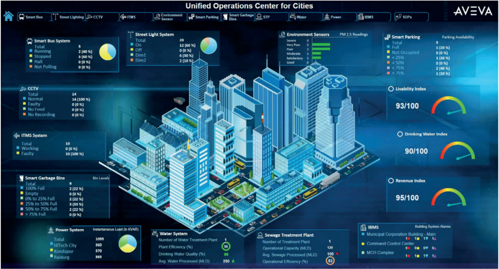
数字孪生是一种新兴技术,可以将现实世界中的城市或其他物体建模成虚拟世界中的对象,为城市的规划、管理和运营提供了全新的手段和工具。在数字孪生技术的支持下,城市管理者可以更加直观、全面地了解城市的运行情况,更好地应对各种问题和挑战,实现城市的可持续发展。
本文将从大规模城市数字孪生的背景、现状、应用和未来发展等方面,对这一领域进行深入探讨和分析。
GIS(地理信息系统)是一种集数据处理、空间分析和决策支持为一体的现代信息技术。在土地利用规划方面,GIS技术已经成为不可或缺的重要工具。GIS技术通过数据获取、数据处理、数据分析和数据展示等环节,为土地利用规划提供了科学依据和决策支持。本文将从数据采集、空间分析、规划决策和实时监测等方面,分析GIS在土地利用规划方面的创新应用。

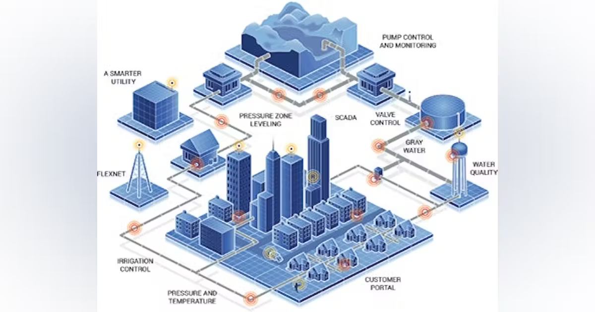
随着科技的快速发展和全球气候变化的不断加剧,水资源的保护和利用变得越来越重要。智能水利技术的出现为解决这一问题提供了新的思路和手段。本文将探讨智能水利的定义、技术、应用和前景。

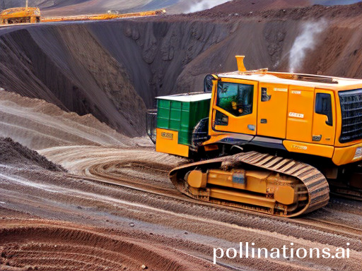
智能矿山管控平台是一种基于现代信息技术的集成化管理系统。该系统可以实现矿山的智能化管理,包括矿山生产、设备管理、安全管理等方面。通过对矿山生产数据的采集和分析,可以实现对矿山生产全流程的实时监控,为矿山管理提供精细化的数据支持。

而在元宇宙的构建过程中,三维实景技术则是不可或缺的重要环节之一。三维实景技术可以将真实世界中的物体、场景、建筑等元素以三维立体的形式呈现出来,从而使得元宇宙的数字世界更加真实、逼真、精彩。

随着科技的进步和社会的发展,生态环境保护日益受到广泛关注。在生态环境管理领域,遥感监测技术已经成为一种普遍的手段,它能够为生态环境管理提供大量的空间数据和信息,实现对生态环境的全面、精细化监测,从而实现生态环境保护的智慧升级。

实景三维技术和实体重建技术的结合,不仅可以帮助我们更好地认识和理解现实世界,还可以创造出全新的数字化体验。本文将从实景到实体,探讨如何通过重建和融合,创造出更加真实和丰富的数字化体验。
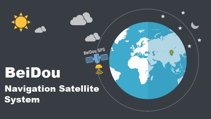
随着人类社会的不断发展,对于位置信息的精度和准确性要求也越来越高。尤其在航空、交通、物流等领域,高精度定位技术已经成为了必不可少的基础设施。而作为中国自主研发的全球卫星导航系统,北斗系统凭借其独特的技术和优势,正在逐渐成为全球卫星导航领域的重要参与者之一。本文将从北斗高精度定位技术的原理和优势入手,结合实际案例,探讨北斗高精度定位在各领域中的创新应用和未来展望。

ChatGPT模型的应用场景非常广泛,其中包括聊天机器人、自动翻译、智能客服、智能写作等多个领域。在智能地图应用中,ChatGPT模型可以用来对用户的语言输入进行自然语言理解和意图识别,从而更加准确地为用户提供地图服务。

智能交通是指通过各种技术手段对城市交通进行智能化管理和控制的系统。其中,智能交通数据是指通过对交通运行状态、交通事故、交通需求等信息的采集、处理和分析,来支持智能交通系统的决策和控制。智能交通数据的创新应用是智能交通系统发展的重要推动力,也是城市交通优化、安全和可持续发展的重要手段。本文将从智能交通数据的意义、创新应用及案例入手,探讨智能交通数据创新应用的思考。
VMWare下扩展Ubuntu系统磁盘、分区并自动挂载

新加坡是世界上最具代表性的智慧城市之一。该城市通过不断推进科技创新,建立了全球领先的智能基础设施和数字经济生态系统,成为全球智慧城市建设的典范之一。在本文中,我将从多个方面详细讲述新加坡是如何打造世界智能城市典范,以及我们可以从中借鉴哪些经验和规避哪些问题。

随着数字技术的不断发展和创新,3D实景地图已经成为数字化时代的一项重要技术和基础设施。其所展现的真实世界、超精细化的地形、建筑、交通等细节信息,不仅可以为用户提供更加真实、立体的视觉感受,同时还可以为社会经济的数字化转型和智慧城市的建设提供重要的支撑和保障。本篇文章将从超精细化的角度,探讨3D实景地图在数字世界构建中的应用和发展。

随着智能技术的不断发展和城市化进程的不断推进,数字孪生城市作为新一代城市管理和规划工具,正在逐渐受到关注。数字孪生城市可以帮助城市管理者更好地了解城市的现状、预测未来的发展趋势、制定更科学合理的规划方案,并实时监测城市运营状况,提升城市治理水平。而GeoAI技术的出现,为数字孪生城市的建设提供了更为精细化的支持和保障。
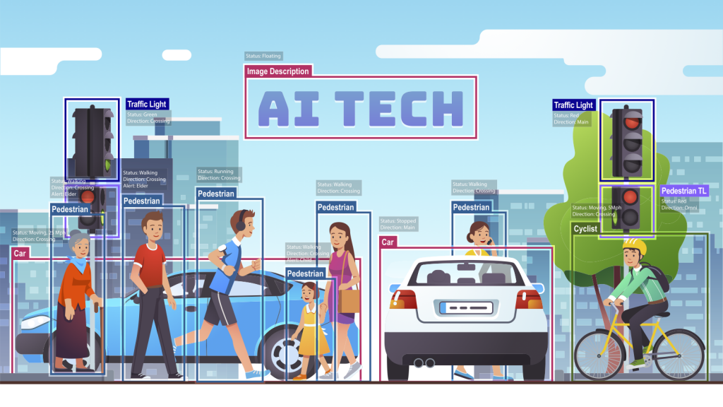
随着人们对出行需求的不断增加,交通拥堵、交通事故等问题已经成为了城市发展中难以避免的问题。智慧交通是未来解决这些问题的关键。AI技术的不断发展和应用,为智慧交通带来了前所未有的机遇和挑战。