Global Monitoring for Environmental Security (GMES)
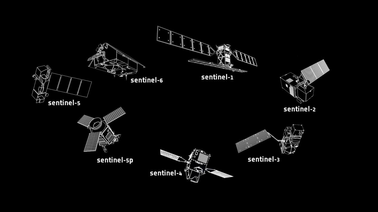
The Sentinel family of satellites observe our land, ocean, and atmosphere from space. All data captured from these satellites are free of charge to encourage maximum use. On top of that, data is available 24/7 and 365 days a year.
Copernicus is the world’s largest and most ambitious Earth observation program in existence today.
Previously known as GMES (Global Monitoring for Environment and Security), it aims to tackle environmental challenges with a fleet of autonomous satellites.
From global warming to land-use change and the atmosphere, Copernicus gathers Earth data from space.
And in the center of it all is its Sentinel family of satellites.
List of Sentinel Satellites
Already, Copernicus has launched several satellites including Sentinel-1, Sentinel-2, and Sentinel-3. Because of its success, there are plans to launch several more.
All data captured from these satellites are free of charge to encourage maximum use. On top of that, data is available 24/7 and 365 days a year.
In general, each Sentinel mission has two twin satellites flying in the same orbit. The reason for this is that it gives better coverage and shortens revisit times.
Whether it’s land, ocean, or the atmosphere, each Sentinel satellite has a specific duty. As shown below, here are the specifications for each one.
READ MORE: How to Download Free Sentinel Satellite Data
1. Sentinel-1

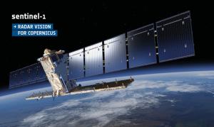
During day and night, Sentinel-1’s instrument sees through cloud and haze using synthetic aperture radar (SAR). At 9-40 meters pixel resolution, Sentinel-1 C-band (C-SAR) is polar-orbiting.
First, the satellite sends microwave pulses to Earth. Next, the pulse hits the Earth and returns to the satellite. Finally, the sensor makes an image from the returned echoes.
Specifically tailored to emergency response, Sentinel-1 can assist in deriving flood maps to plan for mitigation and even minute changes in volcanic activity.
READ MORE: Learn Synthetic Aperture Radar (SAR) by Example
| Mode | Swath | Resolution |
|---|---|---|
| Strip Map | 80 km | 5 x 5 m |
| Interferometric Wide Swath | 250 km | 5 x 20 m |
| Extra-Wide Swath | 400 km | 25 x 100 m |
| Wave-Mode | 20 km x 20 km | 5 x 20 m |
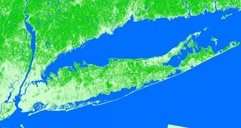
2. Sentinel-2
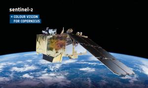
Sentinel-2 monitors the land with a multispectral instrument which includes coastal, red, green, blue, near-infrared, and short-wave infrared.
Every five days, Sentinel 2A and 2B capture land changes in 12 spectral bands. With a revisit time of 5 days, each band ranges from 10 to 60 meters in pixel size.
For us GIS professionals, this is a game changer in free satellite imagery. Instead of 30-meter true color images from Landsat data, we now have access to sharper 10-meter Sentinel-2 imagery. A much-needed improvement.
READ MORE: Multispectral vs Hyperspectral Imagery Explained
| Band | Resolution | Central Wavelength | Description |
|---|---|---|---|
| B1 | 60 m | 443 nm | Ultra Blue (Coastal and Aerosol) |
| B2 | 10 m | 490 nm | Blue |
| B3 | 10 m | 560 nm | Green |
| B4 | 10 m | 665 nm | Red |
| B5 | 20 m | 705 nm | Visible and Near Infrared (VNIR) |
| B6 | 20 m | 740 nm | Visible and Near Infrared (VNIR) |
| B7 | 20 m | 783 nm | Visible and Near Infrared (VNIR) |
| B8 | 10 m | 842 nm | Visible and Near Infrared (VNIR) |
| B8a | 20 m | 865 nm | Visible and Near Infrared (VNIR) |
| B9 | 60 m | 940 nm | Short Wave Infrared (SWIR) |
| B10 | 60 m | 1375 nm | Short Wave Infrared (SWIR) |
| B11 | 20 m | 1610 nm | Short Wave Infrared (SWIR) |
| B12 | 20 m | 2190 nm | Short Wave Infrared (SWIR) |
3. Sentinel-3
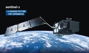
As oceans cover 70% of Earth, they make an important piece of the puzzle for understanding global climate change. In combination with Sentinel-6, the purpose of Sentinel-3 is primarily for monitoring our oceans in detail such as temperature, color, and heights.
At 300-1200 meter resolution, Sentinel-3 will have a less than 2 days revisit time. Because of its large resolution, this is ideal for getting the complete picture of Earth’s heating and cooling system from the oceans.
4. Sentinel-4
Unlike Sentinel-1, 2, and 3, Sentinel-4 will monitor the atmospheric chemistry from a geostationary orbit. This means the satellite is not rotating but it is fixed in high orbit looking at a specific part of Earth.
And Sentinel-4 will not be its own satellite, but it will be an instrument onboard MTG-S. In 2022, it’s set to launch with an 8 km resolution and a 1 hour revisit time.
5. Sentinel-5
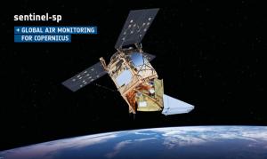
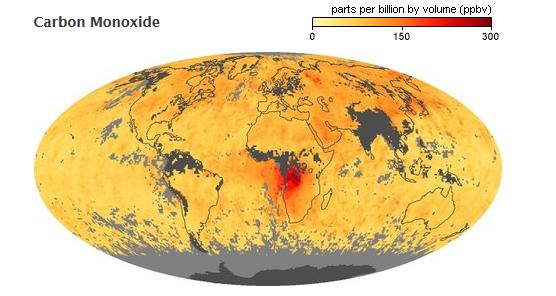
Sentinel-5 monitors air pollution in the atmosphere from a sun-synchronous orbit. For example, it will capture ozone, NO2, SO2, CO, aerosol, and trace gases.
In a low orbit, its spectral bands range from ultraviolet, visible, near, and short-wavelength infrared. Because Sentinel-5 will have a broad 7-50 kilometer resolution, it will have a short revisit time of only one day.
6. Sentinel-6
Finally, Sentinel-6 will concentrate on the activity in the oceans. Similar to NASA’s Jason-1 and 2, this satellite is meant to measure ocean height. It will complement Sentinel-3 by working together for a comprehensive picture of Earth’s oceans.
The primary instrument onboard Sentinel-6 will be a radar altimeter. From radar altimetry, we can map out global sea surface levels with higher precision.
7. Sentinel-7
As plans are still in the works, we don’t have any concrete information available for Sentinel-7. From what is rumored, Sentinel-7 is believed to monitor carbon dioxide (CO2) and atmospheric pollution.
8. Sentinel-8
Nothing is set in stone for Sentinel-8 yet. But Sentinel-8 is rumored to be a thermal infrared sensor for understanding drought, forest fires, and volcanic activity.
9. Sentinel-9
There is some speculation that Sentinel-9 could be a polar mission to understand ice thickness and improve weather imaging.
10. Sentinel-10
Finally, Sentinel-10 could be a hyperspectral mission. As there is a clear gap in hyperspectral satellite data, this could be extremely useful for applications such as mining, agriculture, and the environment.
References
Image Credit: European Space Agency (ESA)