

小马看GIS–OpenLayers(三)–目测功能
群中,有位山上的朋友,问OpenLayers怎么实现目测。在我的印象中,OpenLayers不涉及空间计算的功能,结果查了查文档,发现OpenLayers中还是实现了目测功能的。先贴副图片看看效果:
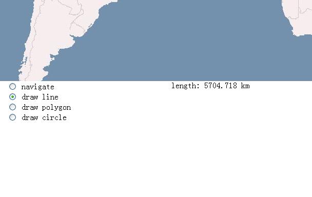


这个例子可以计算两条直线的距离,可以计算多边形的面积。
下面把代码贴出来。
<SCRIPT src="../openlayers/OpenLayers.js"></SCRIPT>
<SCRIPT src="../openlayers/measure.js"></SCRIPT>
<SCRIPT type=text/javascript>
    var map, measureControls;
    //OpenLayers.Util.onImageLoadErrorColor = "transparent";
    function init(){
        map = new OpenLayers.Map('map');
        var wmsLayer = new OpenLayers.Layer.WMS( "OpenLayers WMS",
            "http://labs.metacarta.com/wms/vmap0?", {layers: 'basic'});
        map.addLayers([wmsLayer]);
        map.addControl(new OpenLayers.Control.LayerSwitcher());
        map.addControl(new OpenLayers.Control.MousePosition());
        var options = {
            displayUnits: 'km',
            handlerOptions: {persist: true}
        };
        var circleOptions = {
            displayUnits: 'km',
            handlerOptions: {sides: 35,persist: true}
        };
        measureControls = {
            line: new OpenLayers.Control.Measure(OpenLayers.Handler.Path, options),
            polygon: new OpenLayers.Control.Measure(OpenLayers.Handler.Polygon, options),
            circle: new OpenLayers.Control.Measure(OpenLayers.Handler.RegularPolygon, circleOptions)
        };
        var control;
        for(var key in measureControls) {
            control = measureControls[key];
            control.onMeasure = handleMeasurements;
            map.addControl(control);
        }

        map.setCenter(new OpenLayers.LonLat(0, 0), 3);

        document.getElementById('noneToggle').checked = true;
    }

    function handleMeasurements(geometry, length, area, units) {
        var element = document.getElementById('output');
        var out = "";
        if(geometry.CLASS_NAME == "OpenLayers.Geometry.LineString") {
            out += "length: " + length.toFixed(3) + " " + units;
        } else {
            out += "perimeter: " + length.toFixed(3) + " " + units + "<br />";
            out += "area: " + area.toFixed(3) + " " + units + "<sup>2</" + "sup>";
        }
        element.innerHTML = out;
    }

    function toggleControl(element) {
        for(key in measureControls) {
            var control = measureControls[key];
            if(element.value == key && element.checked) {
                control.activate();
            } else {
                control.deactivate();
            }
        }
    }
</SCRIPT>
看到这句话<script src="../openlayers/measure.js"></script>了吗?OpenLayers版本不同,可能没有这个measure.js。
现在把这个js贴出来,拷贝到您的网站中,这个功能就能实现了。
/* Copyright (c) 2006-2008 MetaCarta, Inc., published under the Clear BSD
 * license.  See http://svn.openlayers.org/trunk/openlayers/license.txt for the
 * full text of the license. */

/**
 * @requires OpenLayers/Control.js
 * @requires OpenLayers/Feature/Vector.js
 */

 /**
  * Class: OpenLayers.Control.Measure
  * Allows for drawing of features for measurements.
  *
  * Inherits from:
  *  - <OpenLayers.Control>
  */
 OpenLayers.Control.Measure = OpenLayers.Class(OpenLayers.Control, {

     /**
      * APIProperty: handlerOptions
      * {Object} Used to set non-default properties on the control's handler
      */
     handlerOptions: null,

     /**
      * APIProperty: onMeasure
      * {Function} After a geometry is drawn, onMeasure is called with three
      *     arguments: the geometry, its length, and its area.
      */
     onMeasure: function() {},

     /**
      * Property: callbacks
      * {Object} The functions that are sent to the handler for callback
      */
     callbacks: null,

     /**
      * Property: displayUnits
      * {String} Units for output.  Must be one of 'in', 'ft', 'mi', 'm', 'km',
      *     or 'dd'.  If null, displayUnits will be assumed to be the same as
      *     map units.
      */
     displayUnits: null,

     /**
      * Constructor: OpenLayers.Control.Measure
      *
      * Parameters:
      * handler - {<OpenLayers.Handler>}
      * options - {Object}
      */
     initialize: function(handler, options) {
         OpenLayers.Control.prototype.initialize.apply(this, [options]);
         this.callbacks = OpenLayers.Util.extend(
             {done: this.measureGeometry, point: this.partialMeasure},
             this.callbacks
         );
         this.handler = new handler(this, this.callbacks, this.handlerOptions);
     },

     /**
      * Method: measureGeometry
      */
     measureGeometry: function(geometry) {
         var area = this.getArea(geometry);
         var length = this.getLength(geometry);
         this.onMeasure(geometry, length, area, this.displayUnits);
     },

     /**
      * Method: getArea
      */
     getArea: function(geometry) {
         var area = geometry.getArea();
         var inPerDisplayUnit = OpenLayers.INCHES_PER_UNIT[this.displayUnits];
         if(inPerDisplayUnit) {
             var inPerMapUnit = OpenLayers.INCHES_PER_UNIT[this.map.units];
             area *= Math.pow((inPerMapUnit / inPerDisplayUnit), 2);
         }
         return area;
     },

     /**
      * Method: getLength
      */
     getLength: function(geometry) {
         var length = geometry.getLength();
         var inPerDisplayUnit = OpenLayers.INCHES_PER_UNIT[this.displayUnits];
         if(inPerDisplayUnit) {
             var inPerMapUnit = OpenLayers.INCHES_PER_UNIT[this.map.units];
             length *= (inPerMapUnit / inPerDisplayUnit);
         }
         return length;
     },

     CLASS_NAME: "OpenLayers.Control.Measure"
 });
转载自:https://blog.csdn.net/mach365/article/details/2738608


