gis,openlayers,leaflet,gis应用,geoai,geoserver,cesium,python,arcpy,arcmap,webgis,gis可视化
GIS理论
2020-01-15
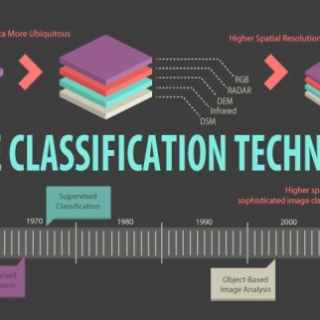
图像分类是将土地覆盖物类别分配给像素的过程。例如,课程包括水,城市,森林,农业和草地。