用shp制作geoJson格式地图数据(shp convert to geoJson)
本文紧接前文,简单说明利用shp数据制作Echarts支持的geoJson格式的地图数据。本文以北京市通州区各镇的shp数据为例进行说明。
今天是香港回归20周年之际,在这个特殊的日子,祝愿祖国繁荣昌盛,愿世界和平。
软件环境:
ArcGIS 10.2 (ArcGIS 10.2安装传送门)
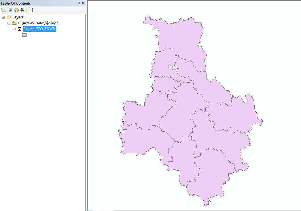
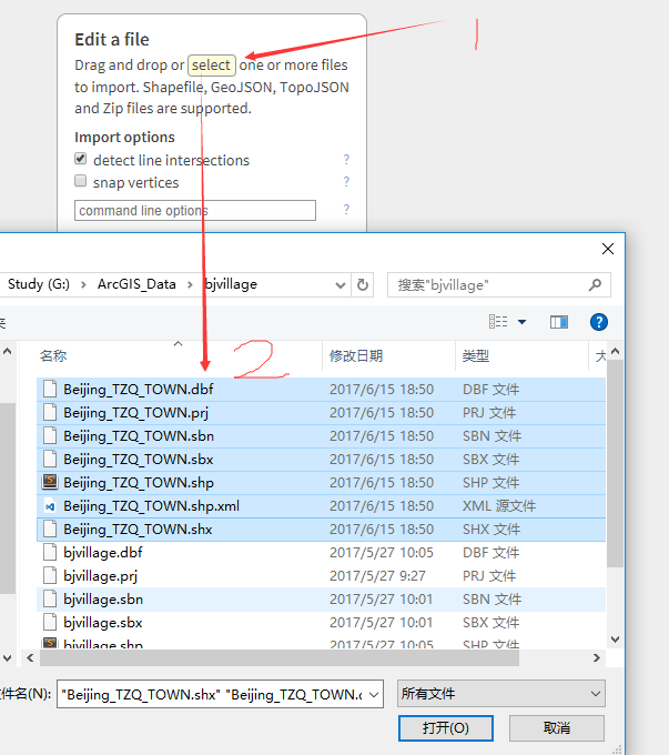
1. 加载数据,将shp数据加载到ArcMap中
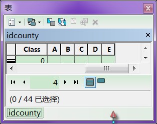
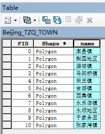
2.为shp数据增加一个name字段
由于Echarts默认以name为字段标识地区名称,因此要为shp数据增加一个name字段,其值为各镇名称。保存数据。
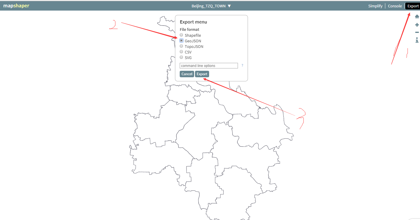
3.转化为geoJson格式
这里利用一个在线转化工具进行数据转换,地址:http://mapshaper.org/
点击 select 按钮

选择步骤1中的shp数据
点击 Export 选择 GeoJson 进行导出
4.引入geoJson
			  var mapChart;
			  var option;
			  //use json file to make map layer
			  $.get('../../js/Beijing_TZQ_TOWN.json', function (beijingJson) {
			  		echarts.registerMap('北京', beijingJson);
			  		mapChart = echarts.init(document.getElementById('map-wrap'));
			  		option = {
		  				title:{
		  					text: '通州区各镇人口密度图',
		  					left: 'center'
		  				},
		  				tooltip: {
				            trigger: 'item',
				            formatter: '{b}<br/>{c} (个)'
		        		},
		        		toolbox: {
				           show: true,
				           orient: 'vertical',
				           left: 'right',
				           top: 'left',
				           feature: {
				               dataView: {readOnly: false},
				               restore: {},
				               saveAsImage: {}
				           }
		        		},
		        		visualMap: {
					            min: 0,
					            max: 2000,
					            text:['高','低'],
					            realtime: false,
					            calculable: true,
					            inRange: {
					                color: ['lightskyblue','yellow', 'orangered']
					            }
		       			},
		        		series:[
		        			{
		        			name: '通州区各镇',
		               	 		type: 'map',
		               	 		map: '北京', // 自定义扩展图表类型
		               	 		aspectScale: 1.0, //长宽比. default: 0.75
		               	 		zoom: 1.1,
		               	 		roam: true,
				                itemStyle:{
				                    normal:{label:{show:true}},
				                    emphasis:{label:{show:true}}
				                },
			        			data: [] //需要动态加载data内容
		        			}
		        		]
		  			}
		 		 	mapChart.setOption(option);
});这里特别要注意的是:series中 map属性要为’北京’,这个根据你geoJson数据所表示的地区而定,加入你制作的是西安市geoJson数据,这里map要写’陕西’,这样初始地图的大小才较为合适。
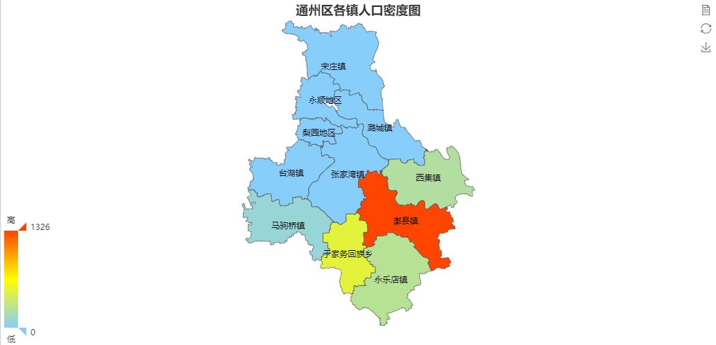
5.最终效果
下一篇文章将对series对象的 data 属性所需数据进行动态组织
如遇到问题,欢迎通过公众号留言给作者,以便共同探讨。
邮箱:thinkingingis@qq.com
微信公众号:

当然本文也是支持赞赏的:)

转载自:https://blog.csdn.net/gisboygogogo/article/details/74056563