GIS 中的 3D 分析工具
3D 分析一直是 GIS 中的增长趋势,因为它可以更好地表示现实世界。
这不仅仅是为了一张漂亮的照片。对于某些类型的问题,3D 分析有时是您解决它们的唯一方法。
推动这一需求的 3D 数据类型也呈爆炸式增长。例如,激光雷达、 BIM 、无人机、纹理网格、摄影测量、钻孔、物联网、增强现实、 InSAR 、时空立方体和室内映射都是 3D 数据的示例。
但是有什么样的工具可用?以下是 GIS 中一些常见的 3D 分析类型。

gis,openlayers,leaflet,gis应用,geoai,geoserver,cesium,python,arcpy,arcmap,webgis,gis可视化
3D 分析一直是 GIS 中的增长趋势,因为它可以更好地表示现实世界。
这不仅仅是为了一张漂亮的照片。对于某些类型的问题,3D 分析有时是您解决它们的唯一方法。
推动这一需求的 3D 数据类型也呈爆炸式增长。例如,激光雷达、 BIM 、无人机、纹理网格、摄影测量、钻孔、物联网、增强现实、 InSAR 、时空立方体和室内映射都是 3D 数据的示例。
但是有什么样的工具可用?以下是 GIS 中一些常见的 3D 分析类型。
等高线具有常量值,例如高程。但它也用于气象学(等值线)、磁学(等角线)乃至驾驶时间(等时间线)
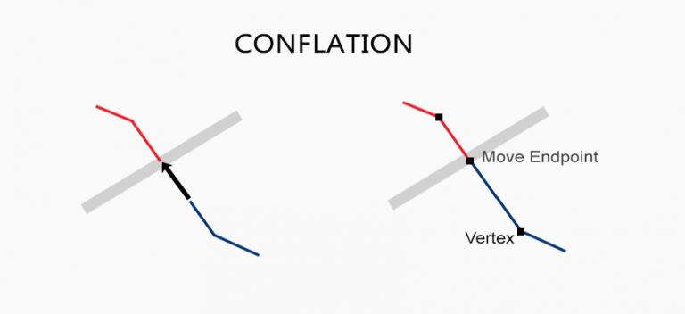
当您有两个相互冲突的数据集时,合并通过保留最准确的数据集来解决冲突。边缘匹配和橡皮页有助于修复错误

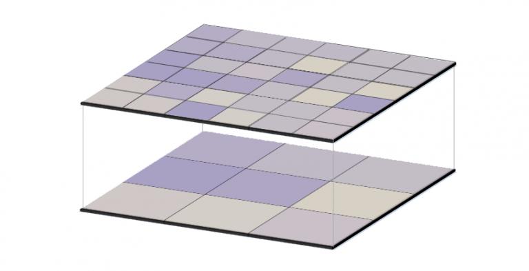
栅格化将矢量转换为栅格。而矢量化将栅格转换为矢量。我们解释了如何从一种数据模型转到另一种数据模型。

生活中有些事情是确定的。在 ArcGIS 中,它是 Esri 999999 错误。以下是解决此 ArcMap 错误并将其解决的一些技术。

在半变异函数的情况下,更近的事物具有较小的变异性并且相似。而距离较远的事物则较难预测且相关性较低。
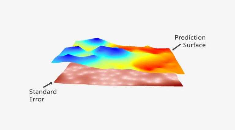
克里金法的预测很强。在本地质统计学指南中,我们踏上了使用克里格插值法构建传奇预测模型的旅程
Huff 重力模型使用商店规模和距离以及人口普查区人口来了解消费者光顾零售商店的可能性。
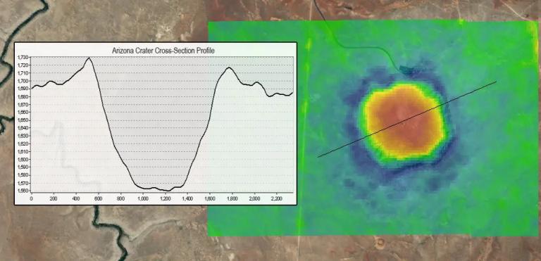
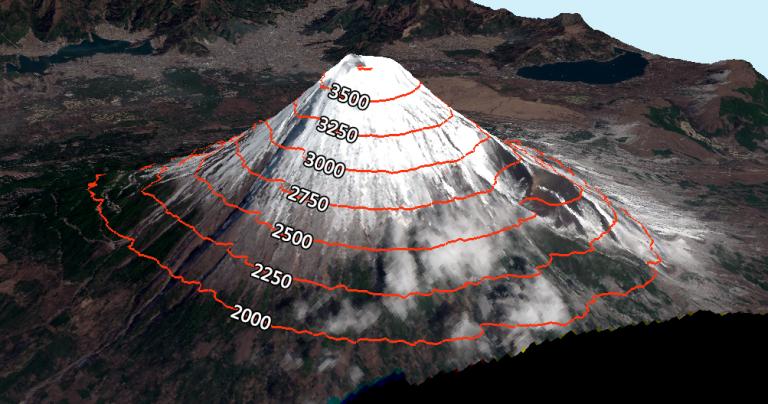
地形图是横截面视图,显示沿线的高程,在工程、水文、土地利用规划等方面的应用。

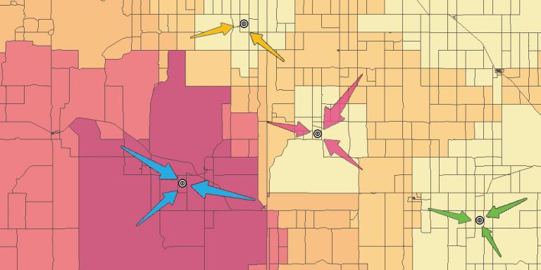
精通技术的公司正在使用位置分配工具来寻找最佳位置和目标市场。这是用于定位贵公司的 ArcGIS 解决方案。
在山区,地势坡度四面八方——东、西、北、南。坡向的罗盘方向为坡向。
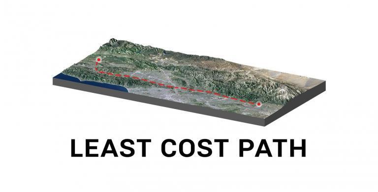
最低成本路径会找到最具成本效益的路径,从起点到目的地,使其成为线性路由的有用工具。

使用 ArcGIS 中的数据驱动页面即时创建数千张地图。了解有关添加动态文本、缩放至范围和导出 PDF 地图册的详细信息

您可以拍摄任何图像,并可以使用 ArcScan 将其矢量化。这意味着您将花费更少的时间进行数字化处理,而将更多的时间花在其他重要的事情上。

使用此快速教程在 ArcGIS 中配置时间序列动画。将地理事件(融雪、森林火灾、疾病)可视化为时间的函数

反距离加权 (IDW) 插值通过指定搜索距离、最近点、功率设置和障碍来估计未知值。

当您在开启 GPS 的情况下拍照时,它会存储拍摄照片的物理位置。地理标记为照片分配坐标。

本指南介绍如何使用 GIS 中的平均绝对误差。我们提供了如何在 Excel 中计算 MAE 的分步说明和一个快速使用的公式。

主成分分析 PCA 识别多个数据集上的重复数据,并将基本信息聚合到称为主成分的组中。
对于 ArcGIS 投影,“定义投影”更改当前投影的元数据。 “项目”工具更改投影坐标系。

GIS 中的均方根误差 (RMSE) 可用于计算预测值与观测值之间存在多少误差。 (例如 DEM 中的错误)
按照这些快速的 5 个步骤将 Excel 经纬度坐标转换为 ArcMap 中的空间数据。设置为 WGS 1984。添加表格。显示 XY 数据。导出形状文件。

ArcGIS 中的 Python 最小值和最大值可以从多个字段中获取。这是使用 Python 和 Field Calculator 使用 min 和 max 命令完成的。

空间自相关帮助我们了解一个物体与附近其他物体的相似程度。 Moran's I 用于衡量自相关。
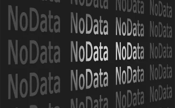
在 arcGIS 中将 NoData 值更改为零可以通过使用“Con Tool”来完成

此列表是最有价值的 Esri ArcMap 提示和技巧的协作成果。遵循这些黄金法则,您将节省时间并改进工作流程。
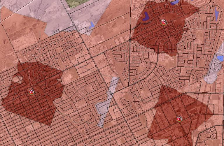
ArcGIS Network Analyst Service Area 分析工具非常适合了解您所在城市的消防员、救护车或护理人员的服务范围。
流向使用相邻单元格的坡度(在栅格网格单元格中)计算水在其八个相邻单元格中的流动方向

空间回归用于模拟空间关系。回归模型研究哪些变量可以解释它们的位置。

图像分析工具栏可以在 ArcGIS 中生成 NDVI 地图。 NDVI 显示高植被和低植被区域,需要红色和 NIR 波段。
对于 GIS 中的栅格重采样,您可以对连续数据使用双线性和三次卷积,对离散数据使用最近邻和多数。

地理编码获取地址,然后将其转换为地图上的位置。它将地址更改为经纬度坐标(纬度和经度)。
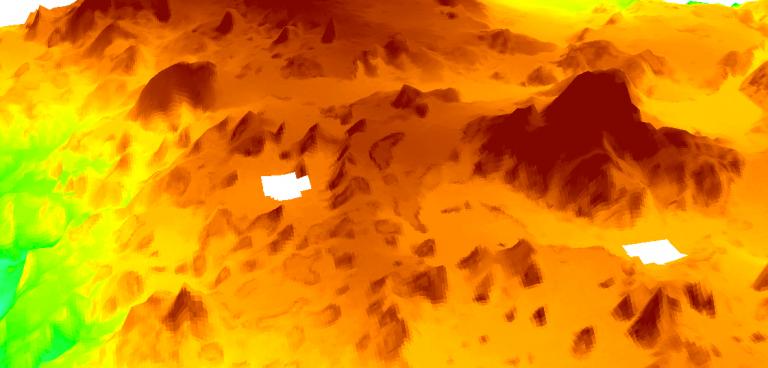
SAGA GIS 有一个使用栅格数据填充 NoData 空洞的快捷工具。我们向您展示如何弥合 DEM 或任何有孔的栅格数据中的间隙。

ArcObjects 是一个组件对象模型 (COM) 库,用于在 ArcGIS 平台之上构建 UI 组件和独立应用程序。
除非您是数据编辑专家,否则您的 GIS 数据可能会在不知不觉中出现间隙和重叠等错误。该怎么办?使用 ArcGIS 中的拓扑工具修复错误

所以您想像 GIS 专家一样进行地理处理,对吗?从裁剪到缓冲,您将学习基本的 GIS 处理工具及其用途和应用

如果您的字母和单词在一个字段中都是大写或小写,并且您想将每个单词的首字母大写,请使用此 Python 代码块。
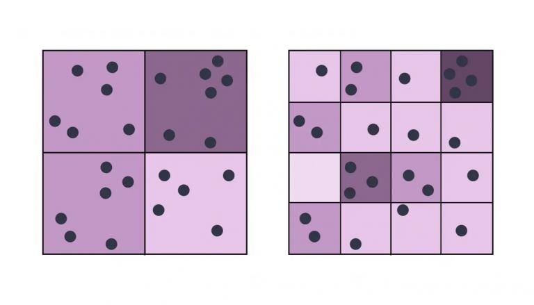
可修改区域单位问题 (MAUP) 是一种统计偏差,当您聚合点数据(如比例和区域效应)时会发生这种情况。

ArcToolbox 是一组用于分析、编辑和转换数据的 GIS 工具。每个工具箱都有一组独特的空间分析专用工具。
这是如何使用 ArcGIS Desktop (ArcMap) 的概述。我们教您用户界面、工具栏、许可证、菜单栏、扩展、窗口等等!
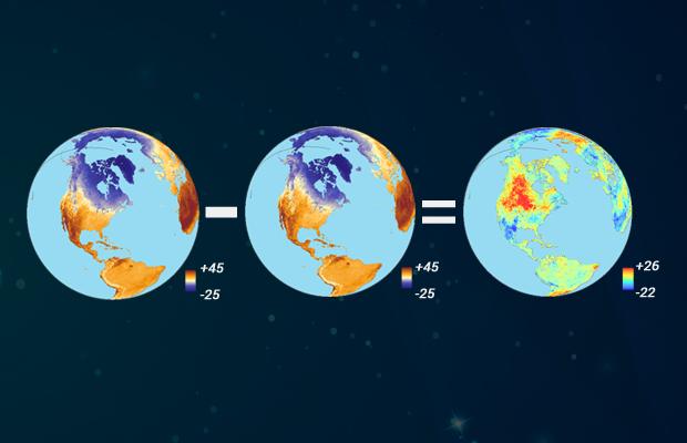
地图代数是堆叠栅格网格的逐个单元组合。它使用具有算术、统计和三角运算符的类数学函数。
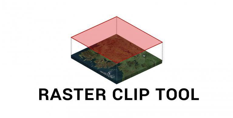
通过学习如何使用 ArcToolbox 中的栅格裁剪工具以及图像分析工具栏中的裁剪按钮在 ArGIS 中裁剪栅格来节省时间。

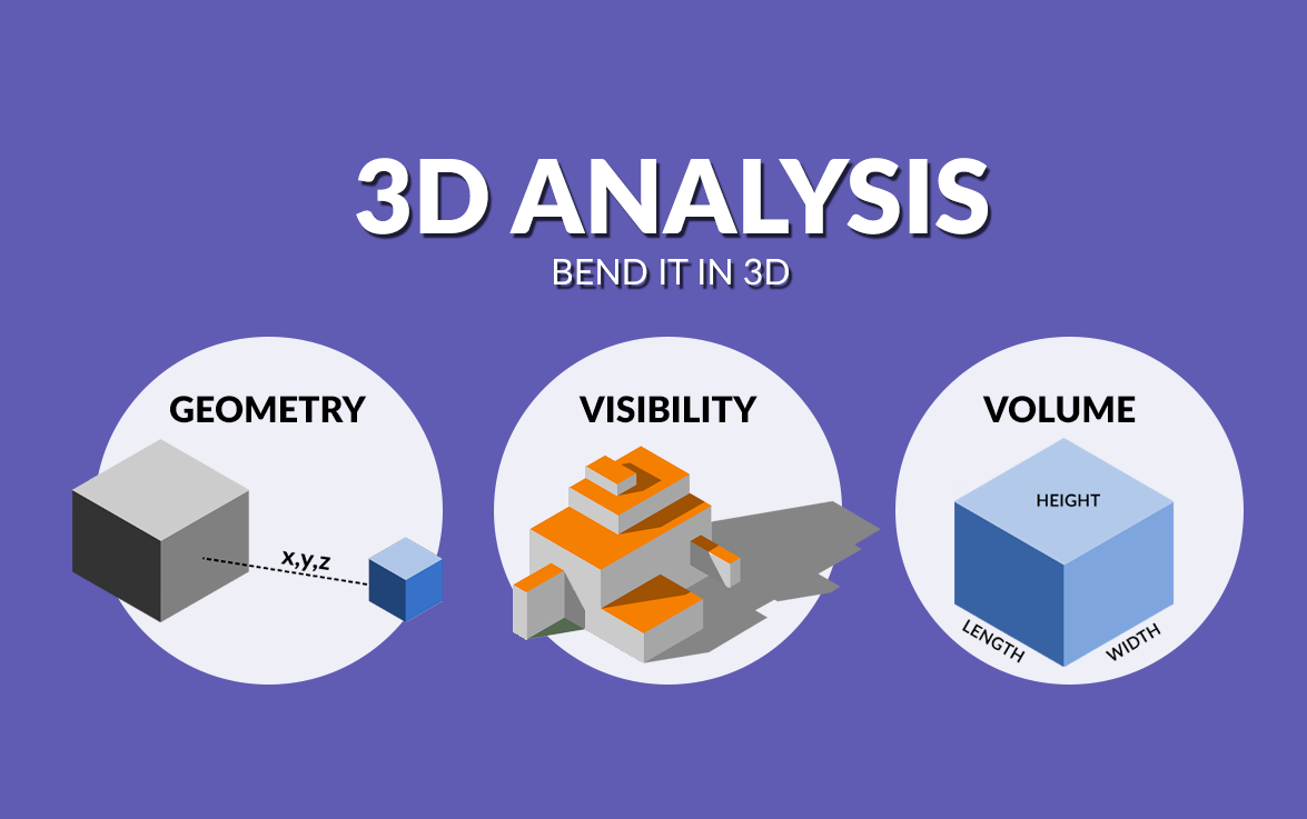
3D 分析是一种日益增长的趋势,因为它能更好地代表现实世界。对于某些问题,3D 有时是唯一的解决方法。
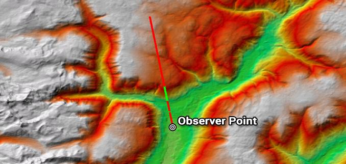
虽然视线决定了一条线上的障碍物和畅通无阻,但视域决定了观察者 POV 可见或不可见的周围区域。
全动态视频将您的视频与地图联系起来。当您播放视频时,它不仅仅显示移动点。它在地图上显示了整个视频足迹。

GIS 中的增强现实 (AR) 允许您通过增强或向手机显示屏添加 3D 功能来与外界互动。
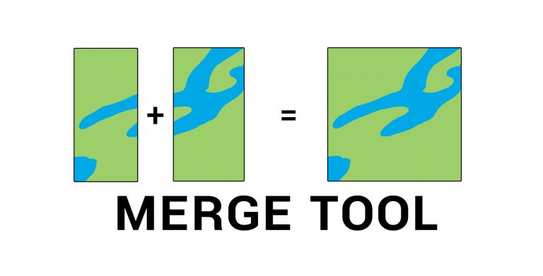
合并工具合并来自多个来源的数据并将它们放入具有相同形状类型(点、线或多边形)的新数据集中。
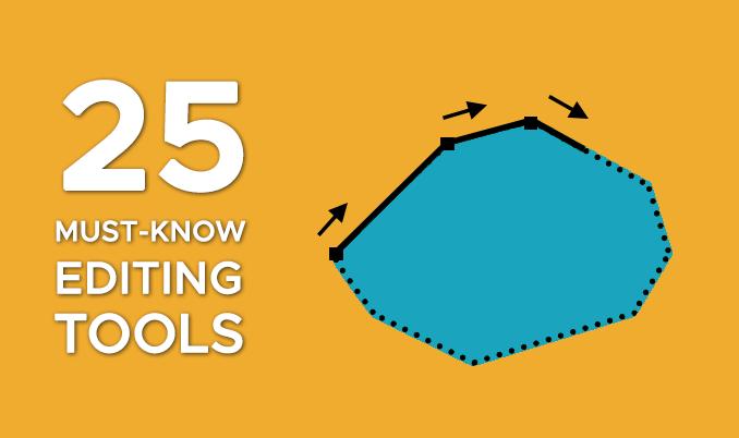
在 GIS 中,您可以通过无数种方式对数据进行切片、切块和编辑。这就是为什么我们使用基本的 GIS 编辑工具创建了这个方便的视觉指南。

距离衰减是指客户离商品或服务越远,他们使用它的可能性就越小。
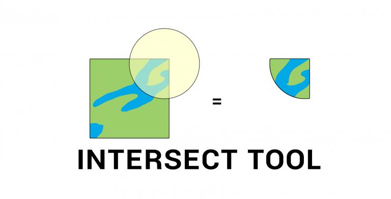
GIS 中的相交工具执行几何重叠。所有重叠的要素和属性都将成为输出要素类的一部分。

室内测绘专门绘制建筑平面图。它可以结合 Revit、BIM 和 CAD,并根据建筑物构建平面图。
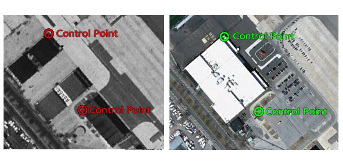
在此地理配准指南中了解如何精确地进行地理配准。在两个图像中添加控制点,选择一个转换并检查您的 RMSE。

如果您使用 ArcGIS 10.2 及更高版本,您可以使用“表格到 Excel”工具将 shapefile 表格转换为 Excel 电子表格并导出字段别名/子类型

地理围栏是虚拟的地理边界。无论是用于安全、零售还是交付,地理围栏都会提供实时警报并提高意识。
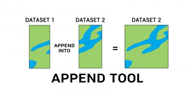
追加工具从一个或多个数据源添加数据并将其放入现有目标数据集中,而无需创建新数据集。
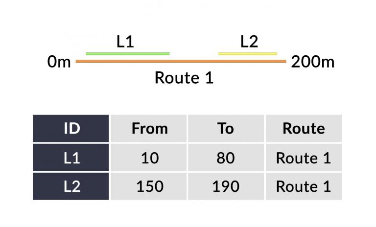
线性参考系统 (LRS) 使用点/线事件和线性分析的 m 值存储现有线要素上的相对位置。
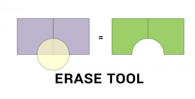
擦除工具移除与擦除特征重叠的区域。擦除层之外的所有内容最终都会出现在输出中。
托布勒地理第一定律指出,一切事物都与其他事物相关,但近处的事物比远方的事物更相关。
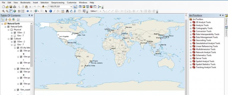
每个人都在寻找“简单按钮”。如果你想知道如何免费使用 GIS 制作地图,我有你的“简单按钮”。使用 QGIS 和 Natural Earth。
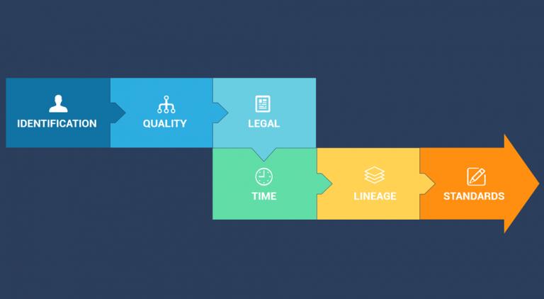
元数据就像数据的使用说明书。它描述了数据的人员、内容、时间、地点和原因。同时,它必须详细且可靠。

