不断发展的位置智能领域:关键趋势和最佳实践
不断发展的位置智能领域:关键趋势和最佳实践

gis,openlayers,leaflet,gis应用,geoai,geoserver,cesium,python,arcpy,arcmap,webgis,gis可视化

不断发展的位置智能领域:关键趋势和最佳实践

从计算机辅助设计(CAD)到建筑信息建模(BIM)的转变标志着建筑项目工作流程的重大革新,涵盖了设计、协作、项目管理和设施管理等方面。对于建筑工程专业人士来说,跟上这一变革是至关重要的。
随着地理空间技术飞速发展,GIS行业面临一个迫切的问题:技能缺口的不断扩大。这不仅是一道难以逾越的障碍,更是迎接创新和适应的关键机遇。解决这一问题不仅需要采用先进的技术工具和解决方案,还需要确保这些工具对各个领域的专业人士既可接受又可用
英国国家地图服务发布了新数据,其中包括对其国家地理数据库(NGD)的重要增强。这些数据涵盖了英国交通网络的要素,以及全国建筑物的占地几何形状和用途

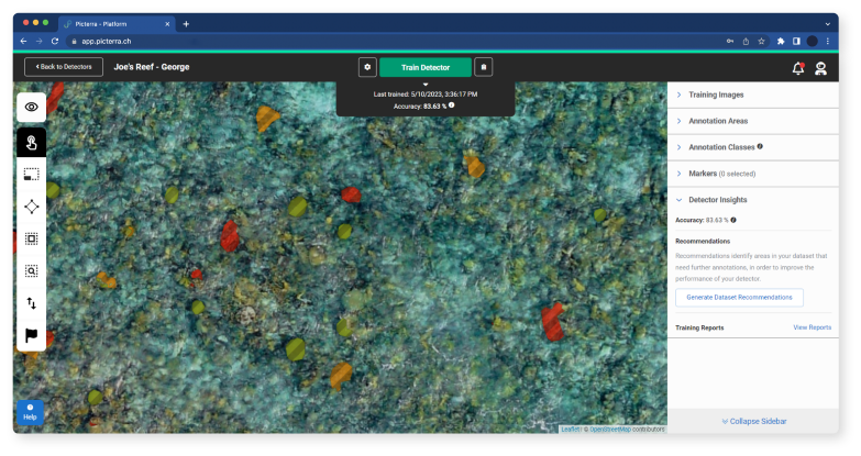
AVIS将提供准确可靠的预测,并增强船舶定位,以优化航线并提高安全性

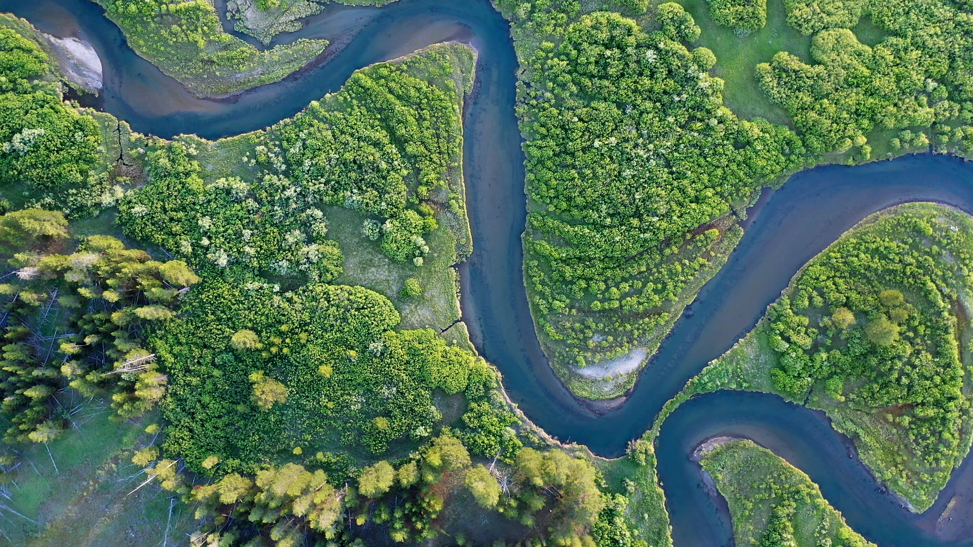
研究显示,世界上75%的工业渔船隐藏在公众视线之外。AI揭秘:卫星图像显示人类海洋活动影响日益扩大。发表在《自然》杂志上的一项新研究提供了前所未有的视角,了解了以前未绘制的海洋工业用途及其变化方式。

汽车定位平台Mapbox在其Autopilot Map、2D实时导航和MapGPT技术中推出了高级驾驶辅助系统(ADAS)L3+的深度集成,使当前和未来的辅助驾驶系统比以往任何时候都更智能、更安全、更易于使用,并具有更大的免提驾驶覆盖范围

excel 将sheet按照名称排序
回顾 GIS 的早期发展对于理解地理空间市场的停滞至关重要。认识到早期采纳者、政府、数据需求和有限的计算机能力对今天的技术和供应商产生的深远影响是关键。有了这种理解,我们就能采取行动推动行业前进。
去年年底,英国宣布管理和维护高速公路和主要 A 级公路的机构 National Highways 获得了 Esri GIS 特别成就奖,使其成为英国唯一的获奖者。根据Esri UK的公告,该奖项是该公司“创新使用地理空间技术的结果,能够更快地响应道路网络上的事件”。
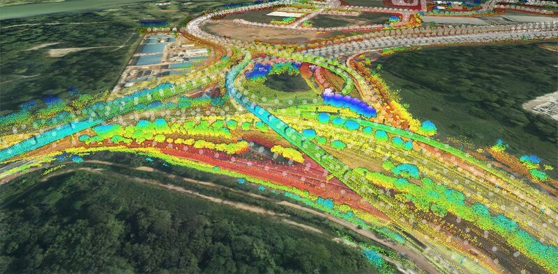
传统方法永远无法跟上快速、高密度点云数据的不断增加。 人工智能来救援了。

2023年在地理空间行业中既有进展又面临挑战。尽管科技行业以其创新成果成为新闻焦点,地理空间领域似乎在年底时变得相对平静。随着当前形式的GIS达到高峰,新的平台和趋势开始出现。它们中的任何一个在2024年是否会取得突破性的时刻呢?
在一台机器上使用多个 Git 账号,并为每个账号配置不同的 SSH 密钥,是一种常见需求,尤其是在处理多个项目或在不同的组织中工作时。以下是设置的步骤:

甘肃积石山县地震,18日晚,甘肃积石山县发生6.2级地震,多省震感明显。地震科普:了解自然动力,应对风险与挑战地震科普:了解自然动力,应对风险与挑战地震是地球内部能量释放的自然现象
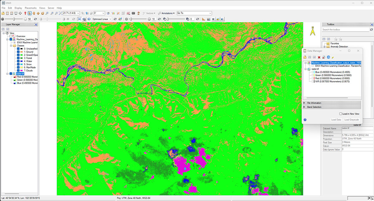
在迅速发展的遥感领域,整合先进技术对于优化洞察力和做出决策至关重要。在这一领域最重要的进步之一是将 ENVI® 和 ENVI Connect 结合起来。
2024年测绘行业的新趋势。这是一场时代的测绘变革,带来了前所未有的机遇和创新。
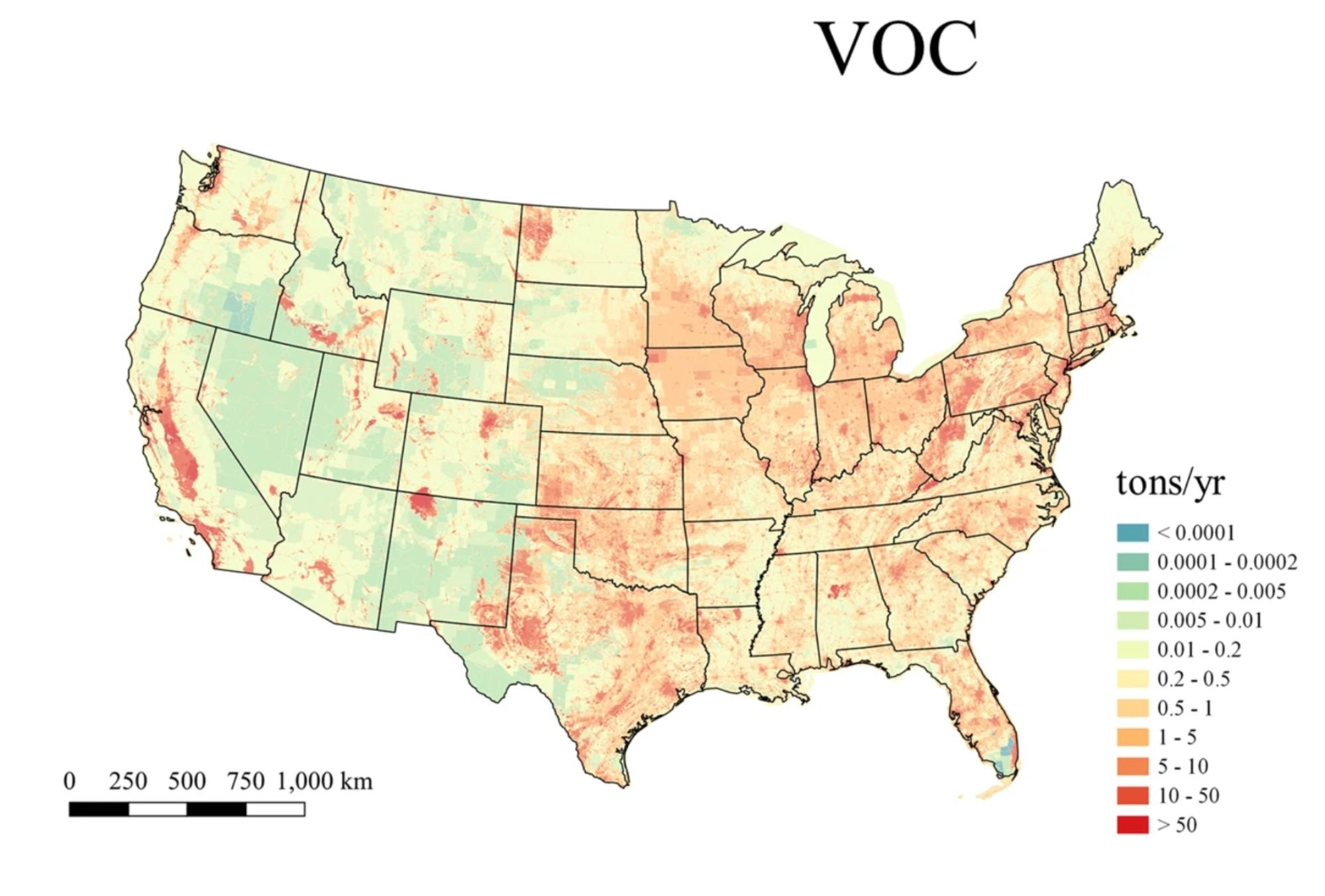
空气污染物对我们的地球和个人健康产生了一些最有害的影响。世界卫生组织 (WHO) 将环境和室内空气污染归因于每年约 670 万人的过早死亡。在美国,据环境保护署估计,大约三分之一的人口生活在不符合国家环境空气质量标准(NAAQS)规定的空气质量水平的地区。要了解暴露于低质量空气中的人数,模型需要精确覆盖受各种污染物影响的区域。
GIS 空间分析建模是创建在计算机中对数据进行编码的模型。它们看起来像是通过数字技术描述地理对象
的抽象和其他结构。简单来说,这些模型将对象转换为连续的表面或地理对象,并为其附加显示坐标的各
种属性。

GIS 技术正在加速发展,可能很难跟上最新趋势并在您的业务中成功实施它们。如果每一种新的技术趋势都给您带来的问题多于机遇,我们都有解决方案。阅读文章,了解 2022-2023 年的 GIS 行业趋势。

这家新成立的卫星公司将采用突破性战略,收集迄今为止捕获到的地球陆地的最完整激光雷达数据。

自从20世纪60年代问世以来,激光雷达(LIDAR)技术已经取得了长足的进步。最初是为了用于军事和航空工业而开发的,但自那以后,LIDAR已经扩展到了许多其他领域,包括测深学。
测深学是研究水下地形的学科,而LIDAR已经成为这个领域中越来越重要的工具。在测深学中使用LIDAR技术可以比传统方法更准确地测绘水下环境。
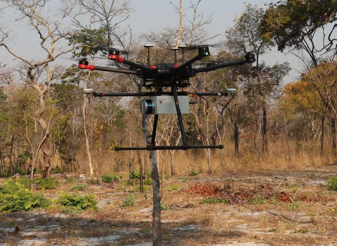
利用UAV Lidar技术提升地雷清除规划,这个案例研究展示了UAV Lidar在检测和绘制地雷场特征方面的优势,这可作为制定清除计划的基础。这些结果可以使清除工作更加安全,并通过有针对性的方法加速清除。
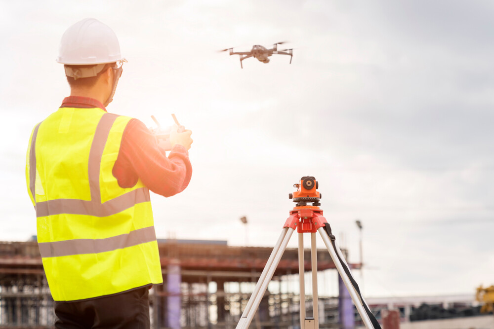
讨论了如何将新技术,特别是无人机图像和GIS辅助的“数字化工地管理板”引入他们的项目,这些技术为他们的工作增添了什么价值,以及他们为未来正在研发的一些其他工具。

本文旨在描述如何使用 GNM C++ 类来处理网络数据。建议在阅读本文之前先了解地理网络数据模型(Geographic Networks Data Model)以理解 GNM 类的目的和结构。
本文旨在描述地理网络模型类的目的和结构。GNM是GDAL的一部分,提供了创建、管理和分析地理网络的方法。
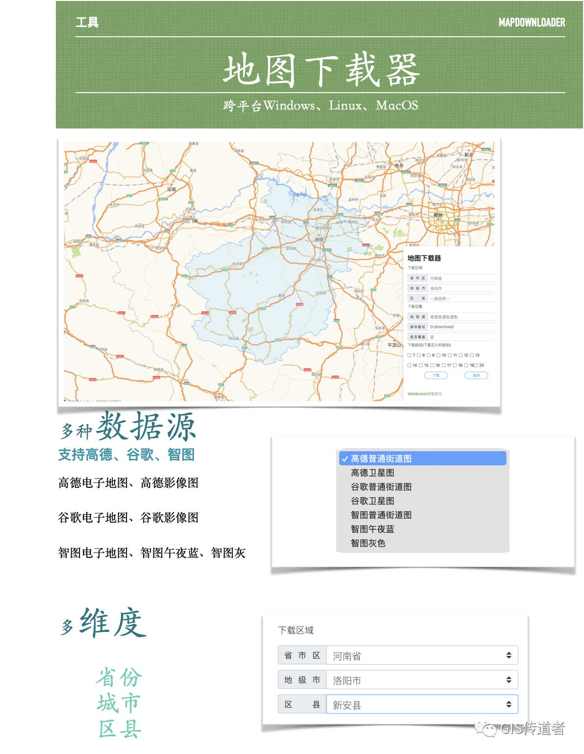
多种数据源
支持高德、谷歌、智图
高德电子地图、高德影像图
谷歌电子地图、谷歌影像图
智图电子地图、智图午夜蓝、智图灰
多维度省份、城市、区县
下载级别任选,占用空间预估,下载速度、进度实时掌控;环境依赖,只需要java环境jdk>1.8

数字孪生技术在缓解城市热岛效应中的应用;康奈尔大学团队如何开发数字孪生网络工具来跟踪和模拟纽约市每棵树的遮荫效应。

夏威夷,这个被誉为”花园之岛”的美丽地方,拥有着令人陶醉的自然风光和令人着迷的文化传统。然而,在这片神奇的土地上,有一个历史悠久的社区,它面临着一个重大的挑战:如何使这个有着19世纪根源的社区现代化,同时又不失去其独特性和文化价值。这个社区就是Kaumakani,这个名字在夏威夷语中意为”风中之地”。
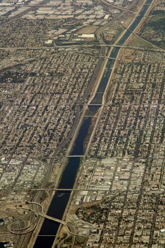
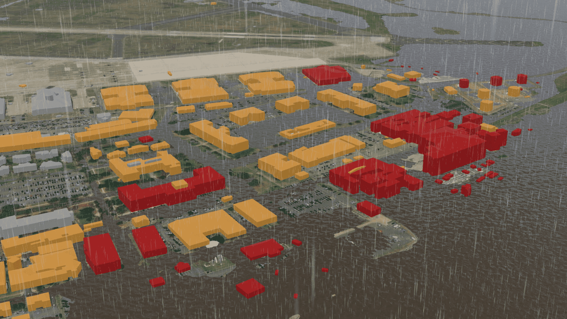
以前所未有的细节揭示洛杉矶的洪水风险。最近,加利福尼亚经历了一系列持续不断的大气河流系统,这是大气中的大量水蒸气,在抵达陆地时释放大量降水的系统。2023年8月底,热带风暴希拉里在洛杉矶地区降下了多达六英寸的雨水。市区发生了街道洪水,周围山区发生了许多道路冲毁事件。这场暴雨提高了历史低水位,结束了该州的严重干旱。但这些河流系统带来的洪水和山体滑坡严重测试了基础设施,危及了生命和生计,说明了气候变化以多种方式增加了世界各地社区的风险。

洛杉矶县使用地理信息系统(GIS)技术识别了保护和恢复的重点区域。
分析师评估了住在开放土地附近但娱乐选择有限的洛杉矶县农村居民的需求。
平等分析指出了在服务不足的社区中修复受损土地的策略。

以下是今年被《快公司》评选为全球最具创新力的公司名单中,位于地理空间和建筑领域交叉处的九家公司。Unity,增强现实和虚拟现实领域第1名GHGSat,北美地区第2名Luminar,交通领域排名第3Capella Space,太空领域排名第3Seoul Robotics,机器人领域排名第4西门子,制造领域排名第4Niantic,增强现实和虚拟现实领域排名第6Pixxel,太空领域排名第8NVIDIA,人工智能领域排名第9
这家实时位置智能公司最近宣布推出了全新的Mapbox Standard核心样式,为他们的地图设计平台引入了全新的3D功能。这个新样式目前正处于公测阶段,在一篇博客文章中,公司表示这个样式“增强了用户的路径导航和空间定位体验,并为定制位置数据提供了一个精致的画布。”新的Mapbox Standard样式可以在最新版本的Web和移动SDK中使用。
数字孪生如何改变桥梁和大坝的检查工作流程。通过使用无人机和其他方法从实地采集数据创建的数字孪生正在使检查更加安全和高效。

考艾岛县如何利用地理信息系统(GIS)来未雨绸缪发展,借助Esri技术,考艾岛县制定了首个海平面上升约束区
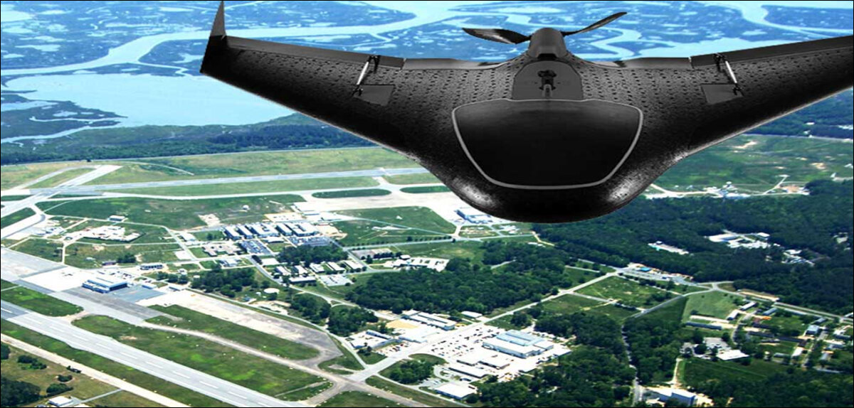
AI的眼睛:LiDAR为人工智能的未来提供关键支持
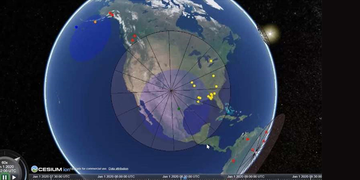
美国纽约州史蒂文斯理工学院的研究人员创建了一个数字平台,使数十家组织能够模拟轨道设备群和地面天线之间的信息交换,以解决复杂的地球科学问题,如火灾的发现。该平台被称为新观测策略测试平台,简称NOS-T。

热成像创新技术使得人工智能能够在漆黑的环境中如同白天一样看得清楚
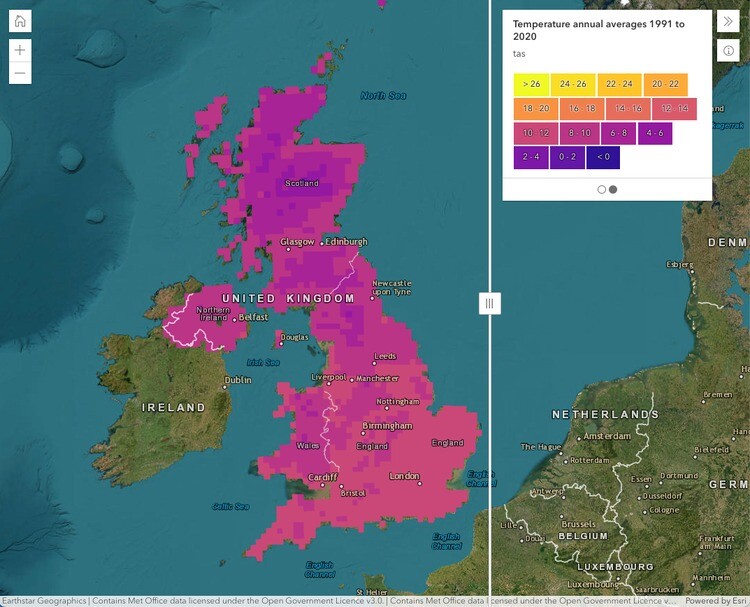
英国气象局推出全新气候门户。由Esri UK提供地理空间技术支持,英国气象局的气候门户旨在为关键气候数据提供更简单和更广泛的访问。

3DUserNetVISION平台解决了现实捕获中的一个关键问题,加速了多传感器项目的工作流程。
来自普渡大学和密歇根州立大学的研究团队推出了一款基于机器学习算法的热成像算法,名为 HADAR。

本文以2023年8月发生在美国夏威夷毛伊岛的大火为例,探讨了森林资源管理与保护的重要性和挑战。文章首先介绍了夏威夷大火的起因、影响和应对情况,然后分析了气候变化、外来植物、警报系统等因素对森林火灾的影响,最后提出了一些改善森林资源管理与保护的建议和措施。
高程数据提升,3D水文测绘重要。美国地质调查局通过3DEP计划提供高分辨率地形数据,但水文数据不匹配。3D水文测绘计划基于3DEP数据,支持洪水模拟等。数据标准化和质量关键,气候变化下数据正确性重要。
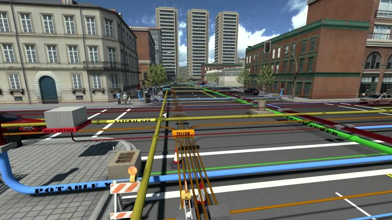
交通部门长期以来一直在使用联网摄像头和条件。这种技术的下一波发展涉及使用嵌入在桥梁和道路中的传感器信息来提供维护需求的信息。现在,从汽车驾驶员和交通工作人员与应用程序互动中输入的数据越来越多。各部门已开始汇总来自车辆之间的无线通信的输入。
位置提供了一个常见的数据元素,将道路、铁路和跑道上的活动与CDOT工程师和工作人员执行的维护和建设移动网络的活动联系起来。
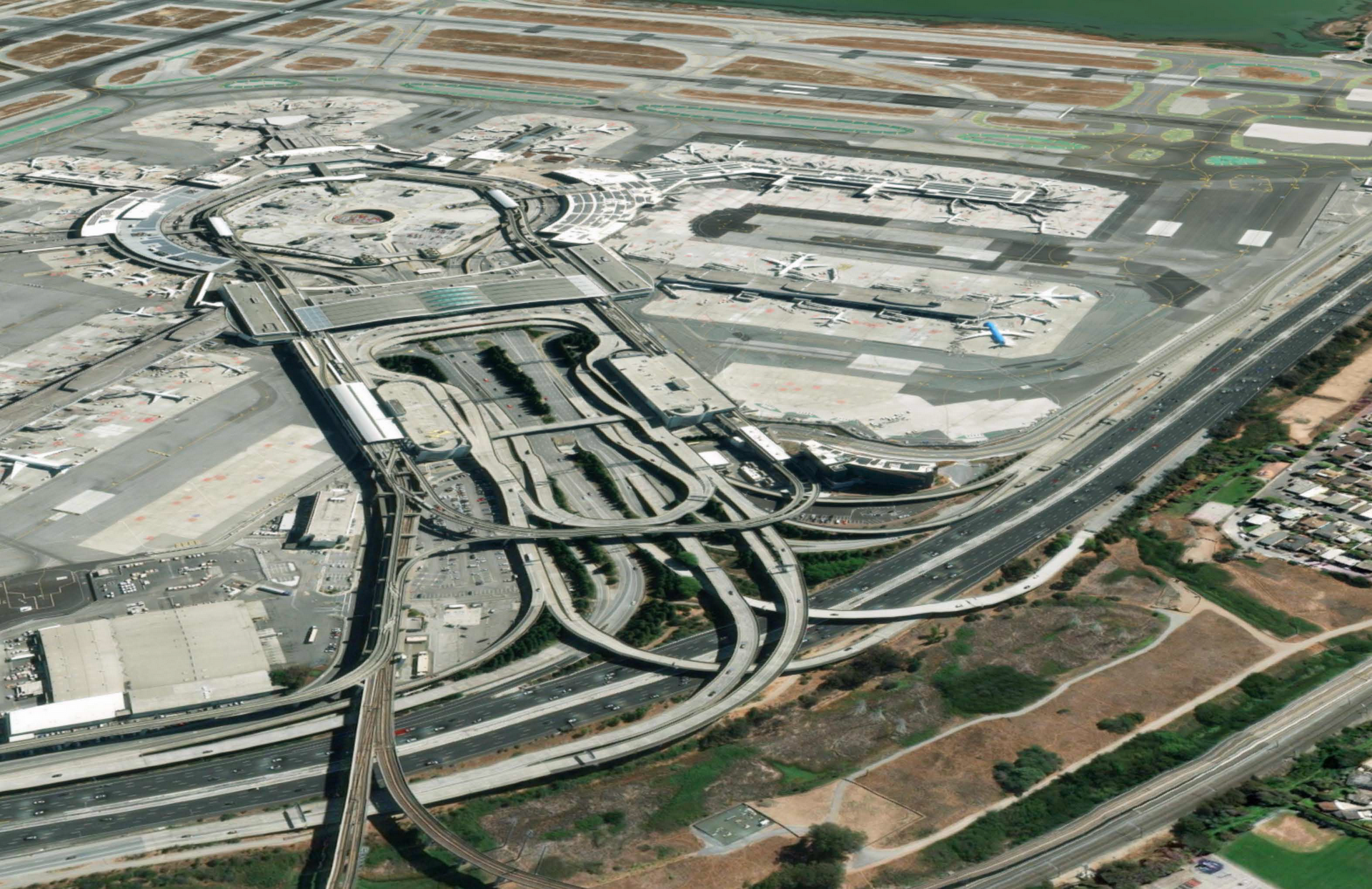
对许多旅客来说,通过提供准确和最新的信息,例如商业空间的位置、紧急服务信息和室内导航功能,旅客可以更好地了解机场的情况,做出明智的决策,并感到更加自主和掌控自己的旅行体验。这种提供先进知识的方法有助于减轻旅客的压力,提高他们的满意度和机场体验。
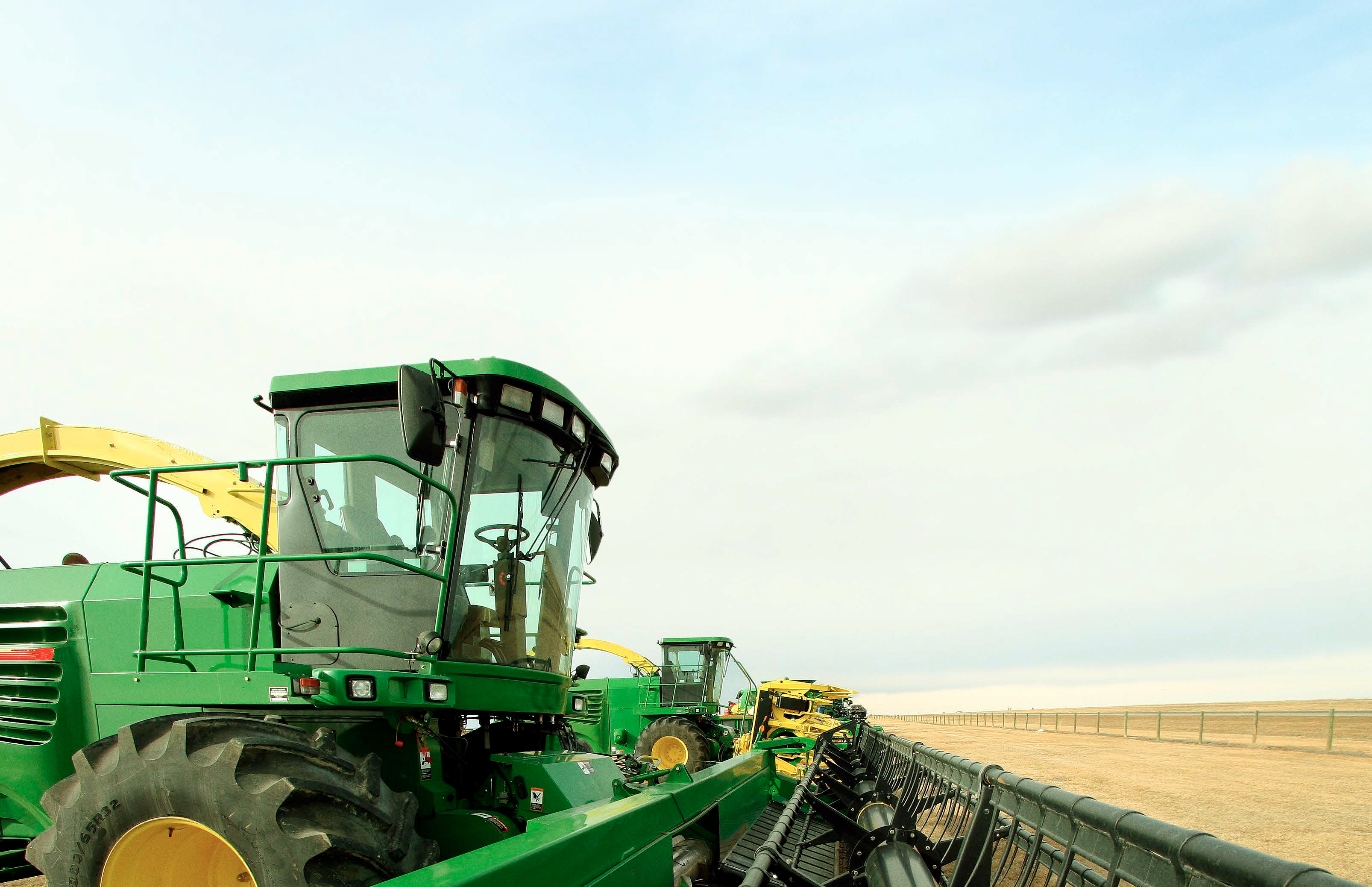
约翰迪尔开发了一种技术,使用地理信息系统(GIS)、设备传感器和机器学习,使农民能够直接在个体杂草上喷洒除草剂,将化学品使用量减少约95%。在一个价值数十亿美元的行业中,考虑到众多因素,让农民能够在微观层面管理他们的田地,不仅对环境产生重大影响,而且还能提高利润率。
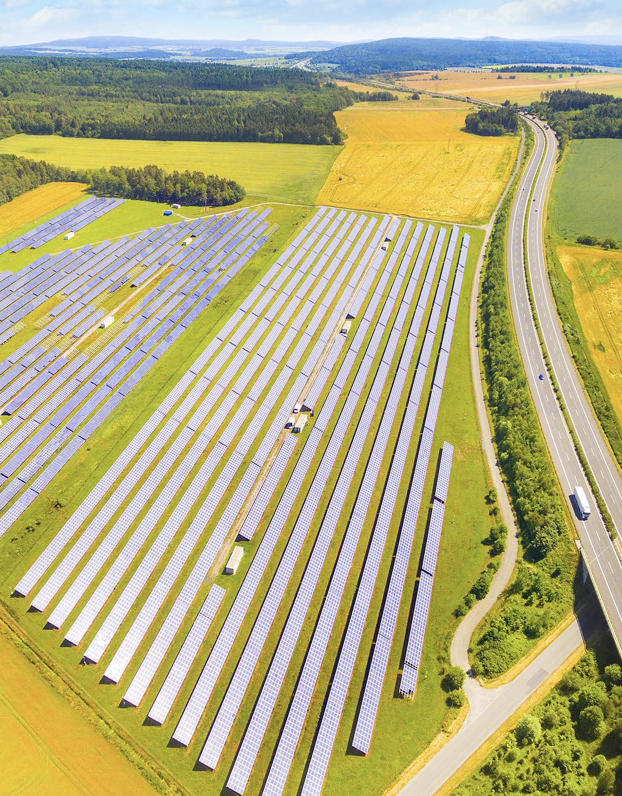
可持续性需求促使我们重新设想土地使用和资源配置。总部位于亚特兰大的非营利组织“The Ray”推动在通常被认为只是美国高速公路系统上的一片空白空间上开展可再生能源项目。
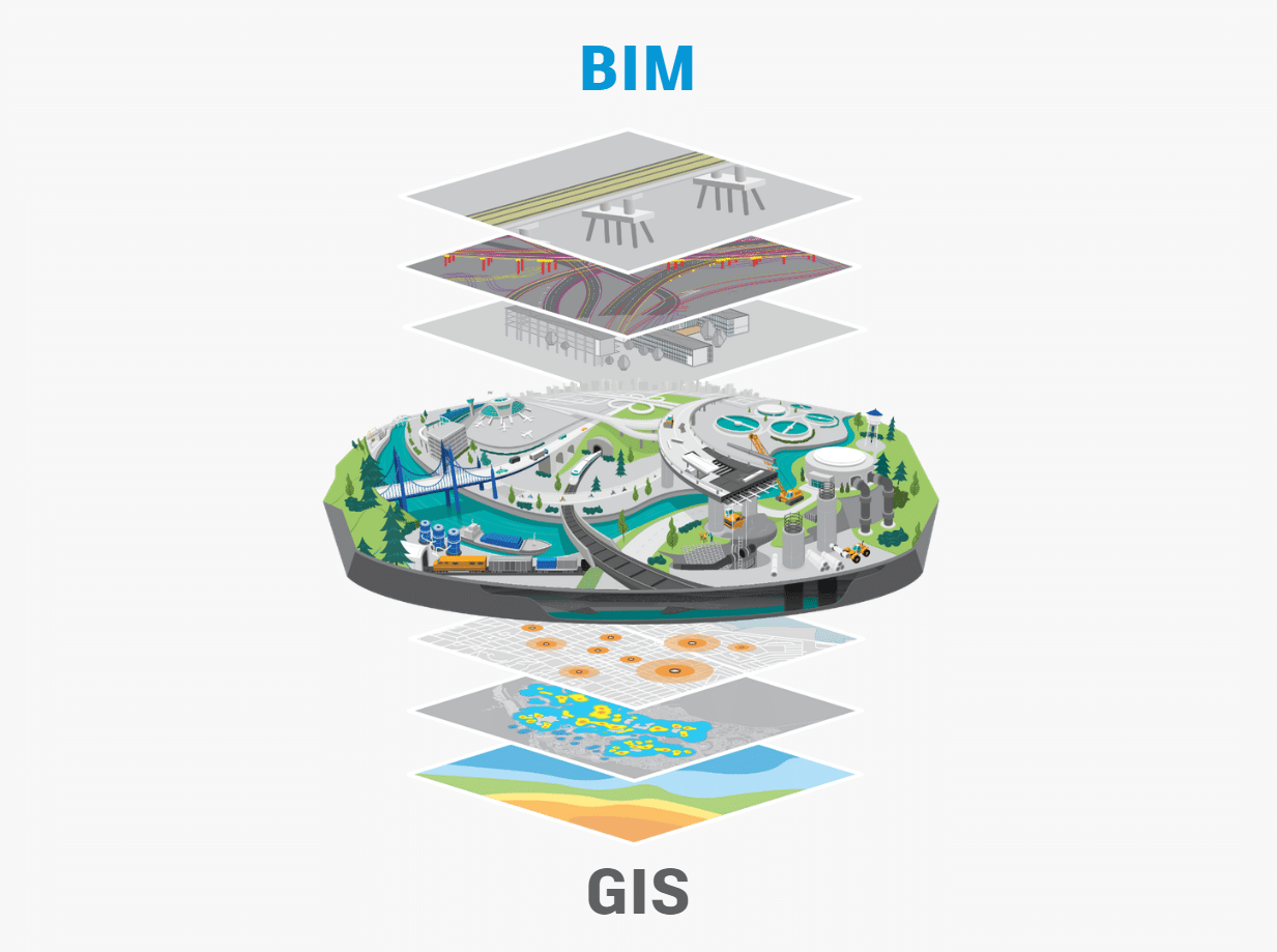
在现代社会中,公路的设计和施工是一个复杂而严谨的过程。为了提高公路项目的效率和质量,BIM(建筑信息模型)和GIS(地理信息系统)的融合已经成为了一种创新解决方案。这篇博客将介绍BIM和GIS的概念,并探讨如何利用这两种技术的融合来实现公路设计施工的信息化。
2022年底,全球生物多样性迎来了一个被长期推迟但具有关键意义的时刻:在联合国生物多样性大会上通过了昆明-蒙特利尔全球生物多样性框架(GBF)。
今年夏天,Hexagon安全、基础设施和地理空间部门宣布了他们的最新产品HxGN Smart Sites。在新闻公告中,Hexagon表示,这款新产品是一个“用于复杂场所运营的实时数据可视化和位置智能解决方案”,并举例工业设施、机场、医院和娱乐场所等是这款产品受益的场所类型。

电力和水务公司已经采用了人工智能和位置智能的力量来提高运营效率。网络运营商利用人工智能和位置智能来检查和管理资产,如输电线路和管道。 预测性...
人工智能(AI)近来成为新闻头条,吓人的标题称其为“文明的终结”,并推测这些超级计算机对我们社会的未来会产生什么影响。的确,我们不知道这一AI智能革命的未来,但我们知道用于训练基于AI的系统的数据集对其输出结果有巨大影响。
数字物流公司的首席执行官加里·安吉尔(Gary Angel)强调激光雷达在人员测量方面的日益重要作用,以及在机场中特别重要的原因。
与本地天气预报相比,一个针对特定建筑和资产的预测才更有用。注重韧性的高管们正在使用GIS技术-一种在科技、银行、零售等各个顶级公司中应用的企业系统-来模拟风暴影响,并了解天气事件可能如何影响建筑物、人员和运营。

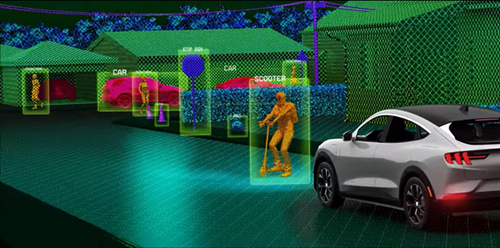
什么使得人工智能和位置智能成为决策变革者

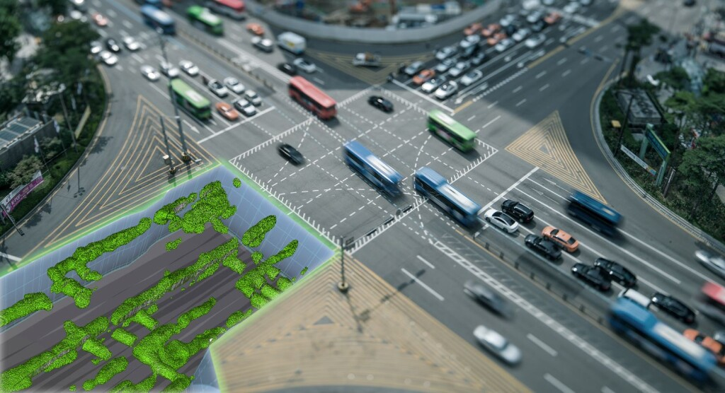
数字孪生是现代技术的崭新领域,它以高度精确的3D模型来模拟真实世界,并为各行各业带来了许多新的机遇和挑战。本文将探讨看似毫不相关的行业——建筑工程、地理空间和游戏之间是如何融合的,并通过游戏引擎呈现数字孪生,如何改变了所有涉及的行业。
新加坡土地局开发了所有公共道路的数字孪生

利用人工智能在地理空间行业的力量:以更少的资源做更多的事情

利用人工智能在地理空间行业的力量:利用人工智能提升安全性
利用人工智能在地理空间行业的力量:负责任地实施具有行业影响力的人工智能