什么是地理数据库?个人与文件地理数据库
如果您对是使用文件地理数据库(*.gdb)还是个人地理数据库(*.mdb) 感到有些困惑……这里有您需要知道的一条。

gis,openlayers,leaflet,gis应用,geoai,geoserver,cesium,python,arcpy,arcmap,webgis,gis可视化

如果您对是使用文件地理数据库(*.gdb)还是个人地理数据库(*.mdb) 感到有些困惑……这里有您需要知道的一条。
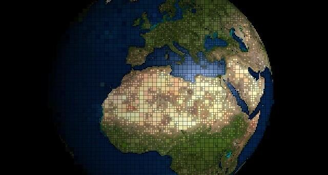
TerraPop 在全球范围内提供具有国际可比性的环境和人口统计数据——包括栅格、区域级和微观数据。
无损压缩(如 JPEG)保留值并减小文件大小。但是,有损压缩(如 LZ77)通过消除冗余来减小文件大小。
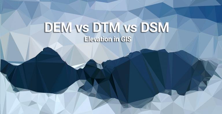
我们探索 DEM(裸地)、DSM(自然和建筑环境)和 DTM(矢量等高线和规则间隔点)之间的差异。
如果您想下载 Sentinel 卫星数据,那么您来对地方了。我们将逐步向您展示如何获取免费的 Sentinel 卫星数据。
从地理数据库到 PostGIS,空间数据库已迅速成为在 GIS 中有效管理空间数据的主要方法。
多年来,USGS 一直是 GIS 数据生产的推动力。我们探索的 USGS 格式是 DLG、DRG 和 DOQ。

部署高效的栅格 GIS 压缩技术意味着减少存储空间。它可以节省金钱和时间,还有助于提高网络性能。
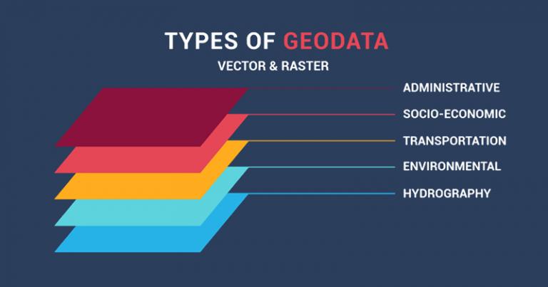
主要的空间数据类型是矢量和栅格。栅格具有网格单元,而矢量是由顶点和路径组成的点、线和多边形。

TIGER GIS 数据改变了 GIS 环境,因为它是第一个全国性数字地图。它刺激了 MapQuest、雅虎和谷歌等项目。

无符号整数栅格是非负数。有符号整数可以存储负值。有符号整数可接受 IMG、TIFF 和 GRID 格式

使用此列表中的 10 个免费、可下载的全球 GIS 数据集,这些数据集来自信誉良好的来源(矢量和栅格),可加速您对免费 GIS 数据的搜索。
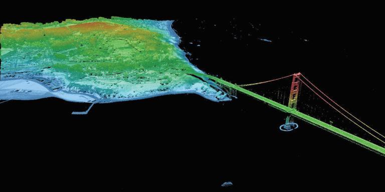
寻找 LiDAR 数据源是不是感觉是一个很大的挑战?通过这份包含 6 个免费 LiDAR 数据源的列表,掌握免费获得 LiDAR 的艺术。
Natural Earth 数据是一个免费的栅格和矢量(文化和物理)数据包,其中包含创建地图所需的最常见元素。

USGS Earth Explorer 可以快速轻松地下载免费的 Landsat 图像和其他遥感数据。输入 ROI,定义时间线并免费下载。

ArcGIS shapefile 文件由必需文件(SHP、SHX 和 DBF)和可选文件(PRJ、XML、SBN 和 SBX)组成。本文列出了它们的功能。

可以在 NWS、PRISM、MADIS 和 Weather Source 找到一些可用的最佳 GIS 天气数据。该 GIS 天气数据可以追溯到过去和现在。

位深度是每个像素中以位为单位表示的细节量。 1 位栅格包含 2 个值,而 8 位栅格的范围为 0-255
想要增加找到数字高程模型的机会?当然可以。您应该深入了解我们的免费全球 DEM 数据源列表。

如果您要搜索免费卫星图像,我们会为来自 NASA、USGS 和 DigitalGlobe 等权威来源的免费卫星数据的最佳来源进行排名。
地理数据是存储在地理信息系统 (GIS) 中的位置数据。通过使用地理数据,我们可以更好地解决需要空间思维的问题。
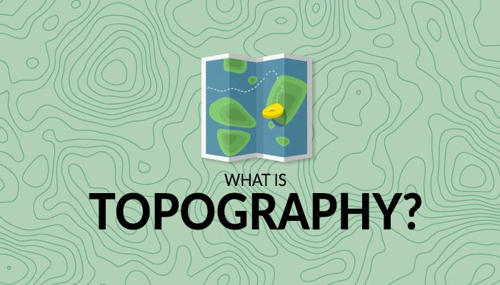
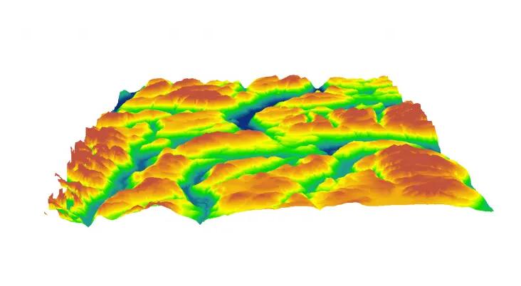
地形奠定了地球表面的基础。在这本综合指南中,您将了解有关地形和地形图的所有知识。
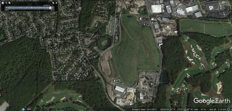
如果您需要历史图像,最好的 Web 查看器是 Google Earth、Esri 的 Wayback Living Atlas、USGS LandLook、NASA Worldview 和 Planet's Stories。
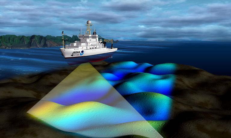
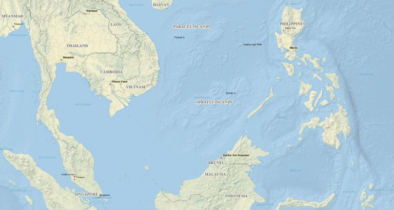
您是否曾经想深入了解海洋并查看其地形?事实证明,您实际上可以使用这份海洋测深数据列表。
OpenStreetMap 就像地图的维基百科。由于开放是其关键理念,OSM 数据也是如此。下面介绍如何下载 OpenStreetMap 数据。

Planet Labs(或简称 Planet)从一个主要想法开始:捕捉我们充满活力的地球……每一天。使用超紧凑、廉价的 CubeSAT 卫星。
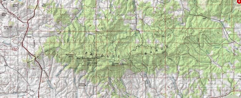
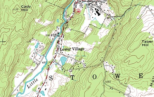
如果您正在寻找美国的地形图(等高线、地名和水文),首先要看的是 USGS 地形图系列。

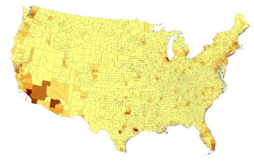
Esri 的 Tapestry 细分数据提供有关客户生活方式选择的见解,帮助您做出更明智的业务决策。
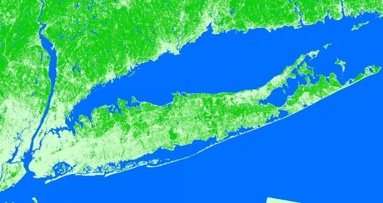
在您的一生中,地球发生了多少变化?相当多,但您可能无法给出一个数字。你实际上可以用土地覆盖。
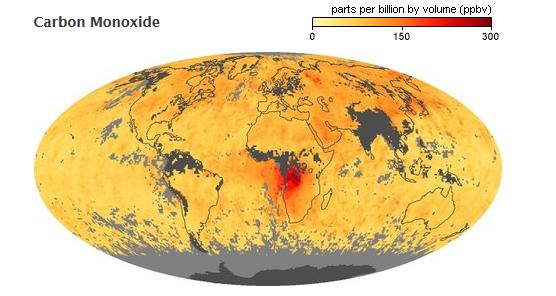
自 1999 年以来,美国宇航局地球观测站一直密切关注环境(火灾、大气气体、土地利用)和全球气候变化。

COGO(坐标几何)是一种工具,可根据地块、道路许可和财产地役权的调查计划绘制几何图形。

我们将顶级几何网络列为 GIS 数据源,您可以将其用于路线选择、地理编码、地图显示或任何类型的网络分析。

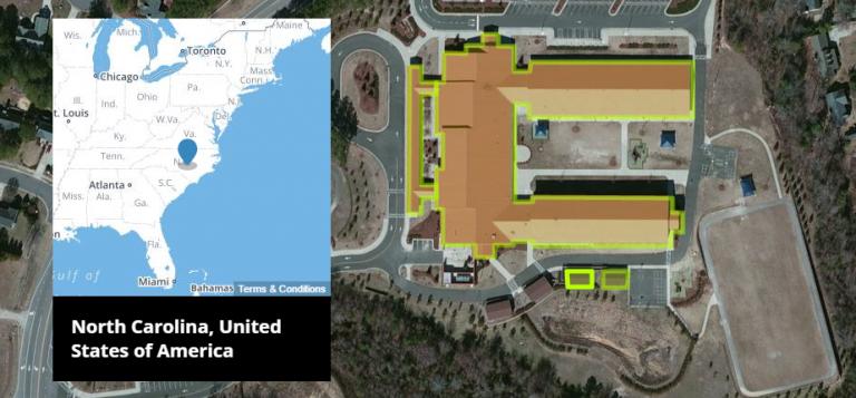
这篇文章专门介绍南极洲数据。如果您想查找南极的数据,那么我们有研究站、卫星图像等等。
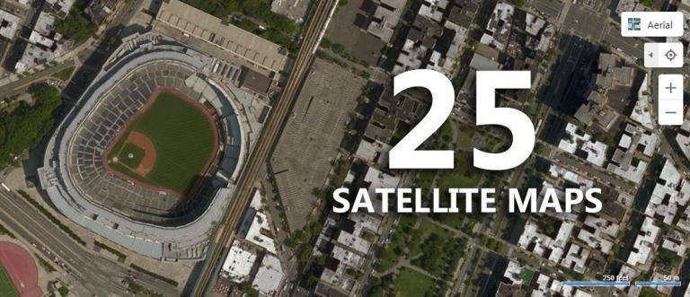
这些是 2020 年排名前 25 位的卫星地图。最好的部分是什么?您将以前所未有的新方式探索地球。让我们开始吧。

俗话说:“你无法管理你无法衡量的东西”。对于测量气候,它是衡量我们星球健康状况的世界气候数据。
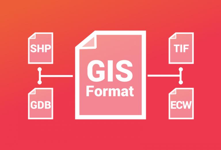
您对 GIS 格式了解多少? GIS 技术人员管理、共享和创建各种地理空间数据格式的数据。查看我们的 GIS 格式列表
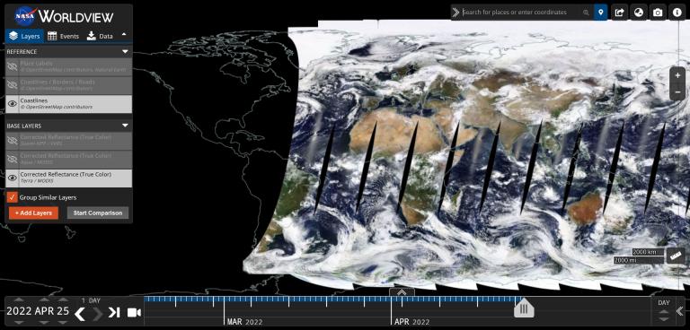
从接近实时的卫星视图到实时馈送,本文旨在向您展示如何查看世界的实时卫星地图。
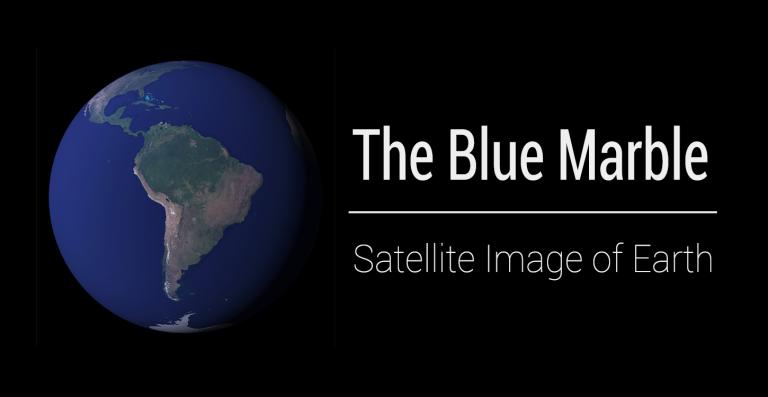
本文介绍了 Blue Marble 的 5 个版本(第一个是 Apollo 17)以及如何下载每个 NASA 地球卫星图像。
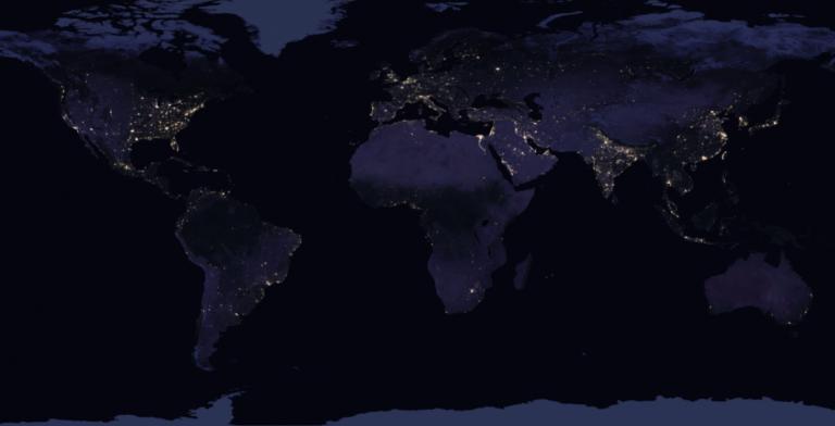
通过拼接来自太空的 400 多张图像,美国宇航局的黑色大理石(夜晚的地球)使用 Suomi NPP 图像绘制了最全面的夜景图。
Esri 的 Living Atlas of the World 是来自世界各地权威提供商的最大的地图、应用程序和数据层精选。