通用电气 (GE) 评论的 Smallworld
GE 在公用事业和网络基础设施领域拥有长期成功的记录。正因为如此,Smallworld 有专门针对网络的增值工具。

gis,openlayers,leaflet,gis应用,geoai,geoserver,cesium,python,arcpy,arcmap,webgis,gis可视化

GE 在公用事业和网络基础设施领域拥有长期成功的记录。正因为如此,Smallworld 有专门针对网络的增值工具。
Manifold GIS 或多或少具有更大的 GIS 软件套件的全部功能。但关键是他们注重速度和低价格。
FME 软件是您的 GIS 数据转换工厂。您加载一种文件格式。它会根据要求生成另一种文件格式。就这么简单。

IDRISI TerrSet 主要用于遥感和图像处理。 IDRISI TerrSet 拥有 300 多种分析工具,非常可靠。
在此 ArcGIS 评论中,我们根据分析、制图、编辑和数据管理功能对其进行排名。查看我们的完整评论并找出它的排名。

AutoCAD Map 3D 具有与 Autodesk 相同的外观。通过链接 CAD 和 GIS,它弥合了设计和地理位置之间的差距。

地球科学家的世界可以使用免费的 SAGA GIS 进行试验。它是 3D 渲染、地形分析和地质统计方面的明显赢家。
uDig(用户友好的 Internet GIS)的重点放在数据库查看和编辑以及丰富的 GIS 功能集合上。

在这篇 QGIS 2 评论中,我们看到了这款开源 GIS 软件如何在制图、编辑、分析和数据管理方面与其他软件相媲美。

Whitebox GAT(地理空间分析工具箱)专门从事地形分析。但是您可以执行 LiDAR 和水文分析等过程。

全天地图。整晚进行地理处理。全部使用开源 gvSIG 软件。 gvSIG 出现于 2004 年。它经过近二十年的微调。
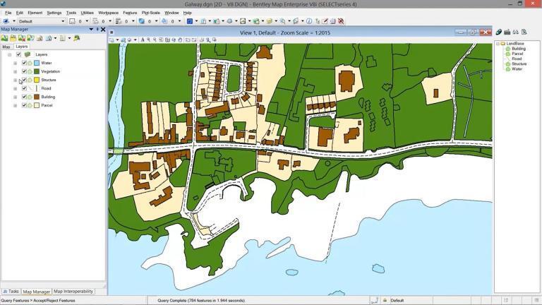
在 Bentley Map 中,我们步入了 CAD 和 GIS 融为一体的世界。它结合了 CAD 的强大功能和传统 GIS 软件的优势。
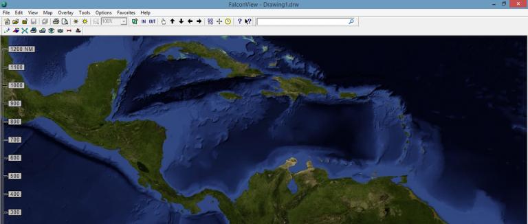
FalconView 不是原型 GIS 软件。相反,它是一个飞行模拟器,可以让您进行飞行规划、模拟和飞行。

Golden Software MapViewer 强调科学数据映射、建模和分析。但它也可以与各种专题地图一起使用。
GRASS GIS(地理资源分析支持系统)是现存最古老的公共领域 GIS 软件之一——已有 30 多年的历史。
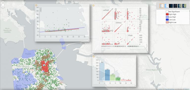
虽然不一定是您的原型 GIS 包,但 GeoDa 在经济、健康和房地产等行业提供令人兴奋的分析和可视化工具
Maptitude 以其作为市场上负担得起的一站式 GIS 商店而自豪,学习曲线低。它在商业和交通方面大放异彩。
公司、政府和军方之所以接受 GeoMedia,是因为其解决方案驱动的方法及其提取可操作信息的能力。

OpenJUMP GIS 擅长基础知识。它最初是作为数据合并的工具。然后,它成长为一个中等规模的开源项目。

Blue Marble 的 Global Mapper 是一个 64 位 GIS 应用程序。它具有强大、直观的界面,尤其是在激光雷达和地形测绘方面。
ILWIS 是免费的(GNU 许可证),供全球用户满足 GIS 和遥感需求。这里有一些巧妙的功能和发展。
当 QGIS 发布新版本时,这是一件大事。因为开源 GIS 软件的无名英雄带着 QGIS 3 回来了!
Precisely(前身为 Pitney Bowes)的 MapInfo Professional 专注于位置智能、业务分析和地理编码服务。
您是否正在考虑切换到 ArcGIS Pro?无论是速度、灵敏性还是简单的原始功能,这里有 17 个立即过渡到 ArcGIS Pro 的理由
在此 Autodesk 评论中,我们将讨论世界领先的设计、工程和施工 CAD 软件供应商。
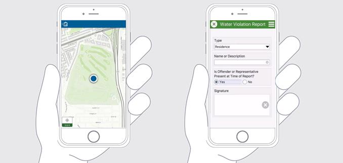
Esri Collector 和 Survey123 是现场数据收集的二合一工具。 Collector 是调用 Survey123 表单进行数据输入的中央应用程序

Mango Map 非常适合不想要精美地图的休闲用户。这个网络制图平台很容易以合理的价格上手。

有大量免费 GIS 软件包可供您绘制世界地图。使用开源 GIS 软件管理、可视化和编辑 GIS 数据。

开源遥感软件有很多选择。这份包含 13 个免费应用程序的列表描述了每个应用程序带来的好处。

我们列出了可用的地理编码和反向地理编码服务(免费和付费服务)以在您的地图上精确定位地址。

CityEngine 是 Esri 的独立桌面应用程序,允许用户为城市设计和城市规划创建 3D 数据模型。
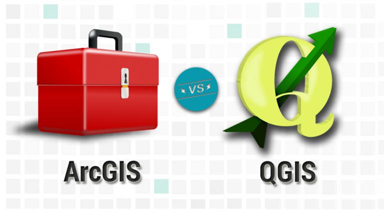
这是一场与 GIS 行业中星光熠熠的阵容 – ArcGIS vs QGIS 的 GIS 软件对决。发现 ArcGIS 和 QGIS 之间的差异
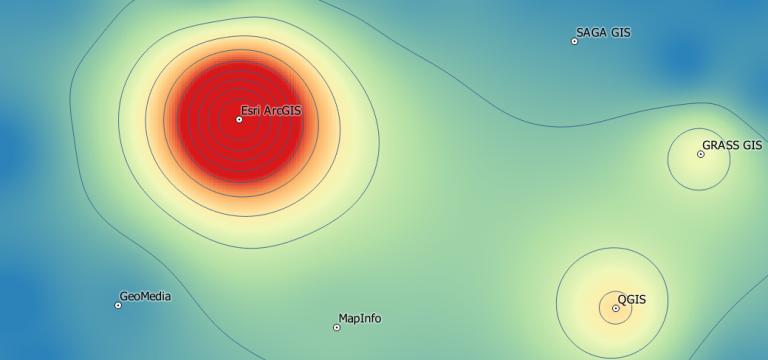
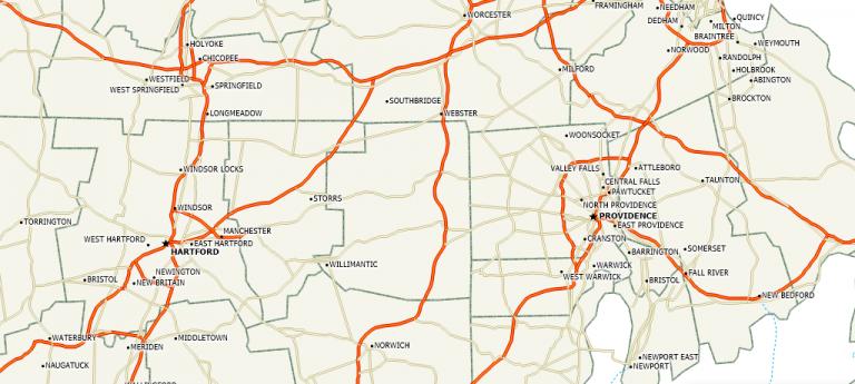
ArcGIS、QGIS、SAGA GIS 到 JUMP GIS。您应该使用什么 GIS 软件?我们描绘了 GIS 软件格局并列出了 30 个选项供您选择。

增强 ArcGIS 能力的最佳方式是通过扩展和加载项。甚至来自 3rd 方提供商的列表也越来越多。
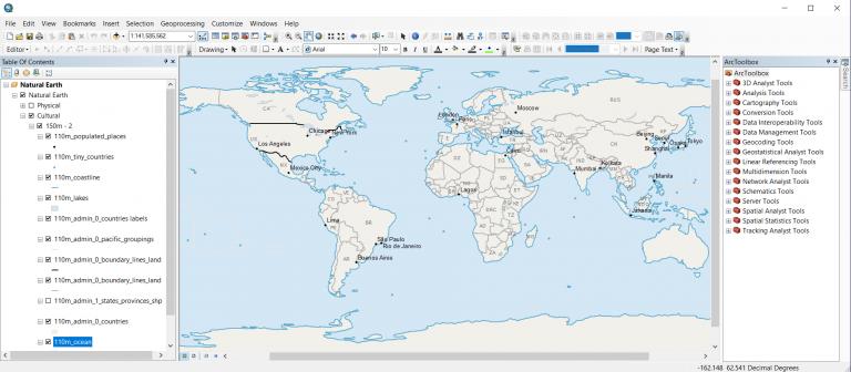
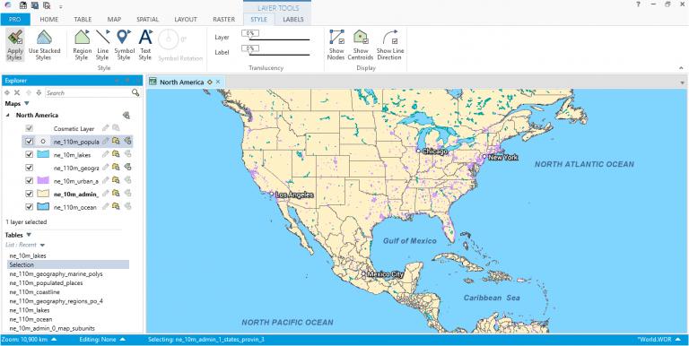
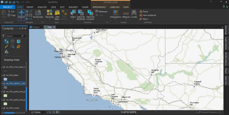
ArcGIS 是一种地理空间软件,用于查看、编辑、管理和分析地理数据和模式。 Esri 开发 ArcGIS 以在桌面、移动和 Web 上进行制图。
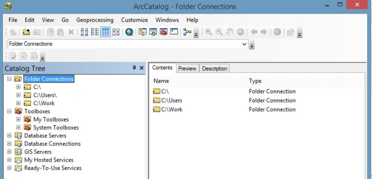
ArcCatalog 就像一个 GIS 数据库。与任何优秀的图书馆一样,您可以收集、存储和管理您的内容。这也是您编写元数据的地方。
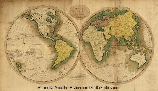
Hawth's Tool 的继任者是 Geospatial Modeling Environment。 GME 提供各种移动、转换、几何和统计工具。
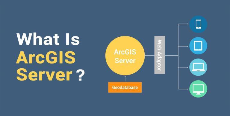
ArcGIS Server 是一项使任何人都可以发布 Web 地图服务并通过 Web 浏览器在 Internet 上使用它们的技术。
ArcScene 和 ArcGlobe 都专注于 3D。但是,ArcScene 是针对局部场景的,而 ArcGlobe 是针对全局场景的。了解 3D 软件之间的更多差异。
与任何 API 一样,Esri JavaScript API 提供了创建您自己的自定义 2D 和 3D 网络地图和网络场景以与之交互的方法。
您是否曾想为您的组织创建交互式 web 地图?或者整个世界呢?您可以使用 Esri 基于云的 ArcGIS Online。
Geosheets 是一种工具,通过添加一套自定义地理空间函数,可以直接在 Google 表格中完成制图和查询
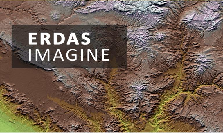
从被动遥感到主动遥感——摄影测量到 LiDAR,ERDAS Imagine 为您提供了所有必要的工具,以进行更强大的图像分析。
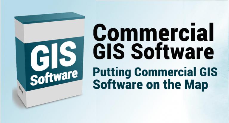
世界各地的企业都在采用商业 GIS 软件,因为有时它更具有商业意义。我们列出了商业地图软件。
运营仪表板是用于跟踪、分析和显示关键指标以深入了解数据和决策的管理工具。
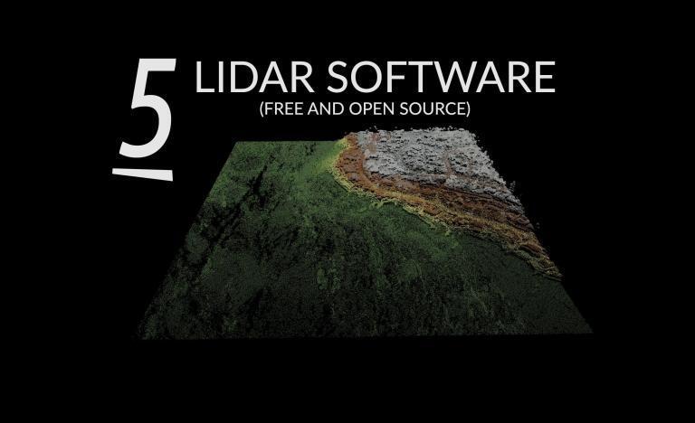
从查看器到桌面应用程序,这些都是用于可视化、分析和转换的最佳免费 LiDAR 软件工具。

Web 制图是一场军备竞赛,战争是在云端。这是一场与 ArcGIS Online、Carto、Mapbox、Mango Map 和 GIS Cloud 的 web GIS 较量。
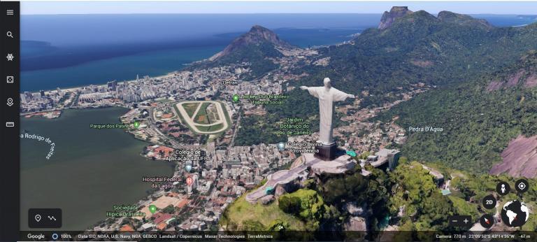
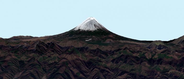
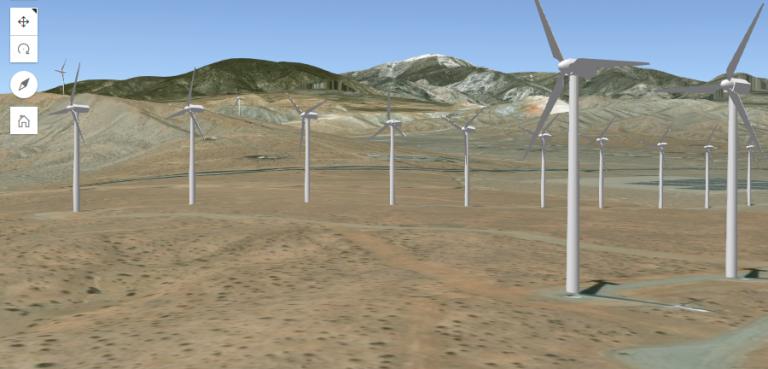
今天您将看到最好的 3D 地图。您可以交互式地在三个维度中围绕建筑物和景观飞行。
很可能您已经在使用 Mapbox,而且您可能不知道! Snapchat 等应用程序将 Mapbox 直接集成到他们的应用程序中。

Carto 是数据与网络地图相遇的地方。 Carto 没有使用桌面 GIS 软件,而是通过一个 Web 浏览器在云中提供了所有这一切。
Web App Builder (WAB) 允许任何人构建功能强大且高度可定制的 GIS 应用程序,这些应用程序无需任何编码即可在任何设备上运行。

我们揭示了用于导航的前 10 个 GPS 应用程序(Android 和 iOS)。有些应用程序会引导您远离车祸、施工和警察等麻烦。
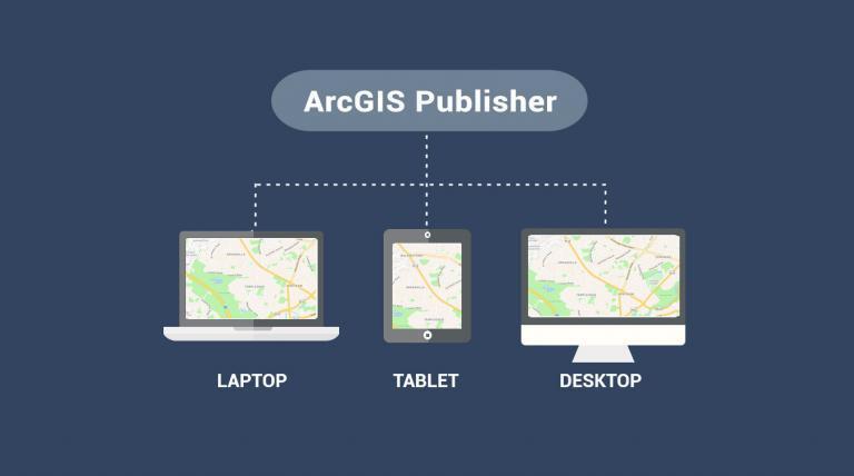
ArcGIS Publisher 通过发布可在 ArcReader 中访问的 PMF 格式的地图,可以轻松共享地图和数据的数字版本。
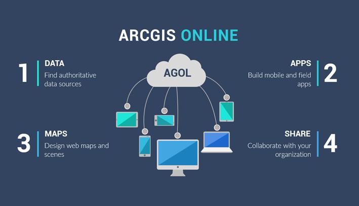
这是一个介绍性教程,介绍如何在 ArcGIS Online (AGOL) 中创建自定义 web 地图以在 web 上进行可视化、共享和协作。

ArcGIS Insights 融合了来自 GIS 的空间分析、数据科学(R 和 Python)和 BI 工作流,它们都集成到一个地方。
故事相遇地图。故事地图是一种以位置为重点来显示特定事件、问题、地点或趋势的交互式方式。
这是我们都偷偷放在口袋里的非地理空间工具的列表。这是 GIS 不具备的功能!
系好安全带。因为您将见证 GIS 软件巨头之间的正面交锋。这是一场复赛。 ArcGIS Pro 与 QGIS 3

QField 是适用于 Android、iOS 和 macOS 的开源移动数据集。您可以构建具有 GPS 定位和摄像头采集功能的表格。

Esri重新规划区工具提供了一种简单高效的方法,可帮助州立法机关重新绘制准确的重新规划区边界图。