
使用1角分高程数据为OpenStreetMap服务器添加海洋等深线
目录
在前文中,我们使用NASA SRTM 数据为陆地添加了3角秒的等高线图层。今天,我们继续为海洋添加等深线。海洋的等深线数据,开放标准的以 etopo1为著名。此数据的分辨率为1角分(arc-min),即 1/60 度。其dem图层为 WGS-84标准投影,在官方网站可以下载。我选择的是grid配准的binary类型数据。
这个数据其实就是一个16位整形的矩阵,大小为 180*60+1行,360*60+1列,即10801×21601。为了把它变成等深线,导入到postGIS里,需要以下几步。
1 使用QGIS转换投影
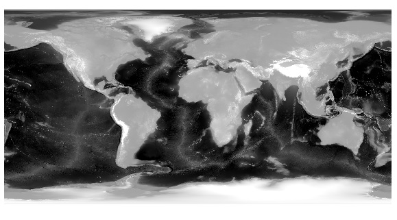
WGS-84 的DEM 默认为 EPSG:4326 投影类型,即最通俗的经纬度。在QGIS中打开下载的原始数据,可以看到灰度化的深度图。
我们首先要把它转化为墨卡托投影,使用QGIS控制台命令
gdalwarp -overwrite -s_srs EPSG:4326 -t_srs EPSG:3857 -r cubic -wm 1024 -multi -dstnodata -32768 -of GTiff H:/OpenStreetMap/oceanDEM/ETOPO1_Ice_g_gmt4.grd H:/OpenStreetMap/oceanDEM/ETOPO1_Ice_g_gmt4_mkt.tif或者直接利用图形界面
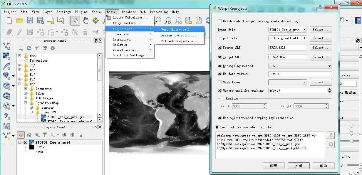
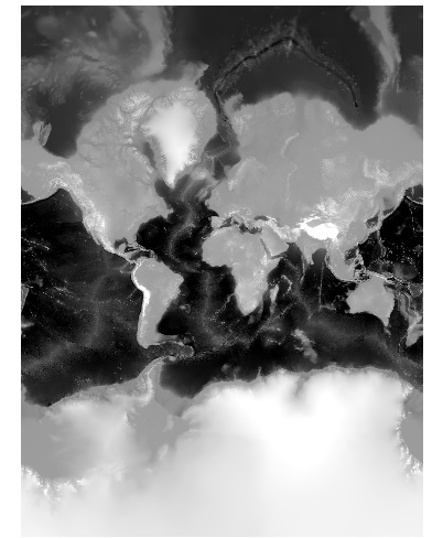
进行转换。转换后,得到墨卡托投影的高程图。
2 使用QGIS控制台向postGIS计算并导入等高线
这一步走了很多弯路。一开始,我尝试首先生成shp文件,而后利用shp2postgis进行导入。然而,这种方法有2GB大小的文件限制。无奈,经过了一天的研究,发现了超级捷径.
2.1 直接计算、导入等高线
直接利用gdal_contour.exe计算并把结果导入数据库contours,命令:
gdal_contour -a ele -i 10.0 -snodata -32768 D:/GIS/ETOPO1_Ice_g_gmt4.grd -f "postgresql" "PG:host=localhost user=postgres password=XXXXXX dbname=contours"导入后,生成了一个表 contour
2.2 修改表以适应现有图层模板
为了能够基本照搬上篇文章的SRTM模板,我们把表格稍微修改一下。
1. 修改字段名 id 为 osm_id
2. 删除>=0的元素: delete from contour where ele >=0;
2. 修改geo字段名为way
3. 添加图层开关字段 contour(text), contour_ext
4. 按照不同的高程进行图层分级:
update contour set contour = 'elevation';
update contour set contour_ext = 'elevation_minor' where ele % 10 = 0;
update contour set contour_ext = 'elevation_medium' where ele % 50 = 0;
update contour set contour_ext = 'elevation_major' where ele % 100 = 0;
5.为字段 ele, way 建立索引。
3 添加样式表与图层
与上一章一样,我们为海洋深度添加样式表ocean_depth.mss:
@depth-above: #3A5FCD;
@depth-shallow: #7A7A7A;
@depth-deep: #778899;
@depth-verydeep: #6E6E6E;

#depth-minor {
    line-width: 0.2;
    [elevation >=0] {
      line-color: @depth-above;
    }
    [elevation < 0][elevation > -2000] {
      line-color: @depth-shallow;
    }
    [elevation <=-2000][elevation >-5000] {
      line-color: @depth-deep;
    }
    [elevation <=-5000] {
      line-color: @depth-verydeep;
    }
}
#depth-medium {
  line-width: 0.4;
  [elevation >=0] {
    line-color: @depth-above;
  }
  [elevation < 0][elevation > -2000] {
    line-color: @depth-shallow;
  }
  [elevation <=-2000][elevation >-5000] {
    line-color: @depth-deep;
  }
  [elevation <=-5000] {
    line-color: @depth-verydeep;
  }
}
#depth-major {
  line-width: 0.6;
  [elevation >=0] {
    line-color: @depth-above;
  }
  [elevation < 0][elevation > -2000] {
    line-color: @depth-shallow;
  }
  [elevation <=-2000][elevation >-5000] {
    line-color: @depth-deep;
  }
  [elevation <=-5000] {
    line-color: @depth-verydeep;
  }
}

#depth-medium-text {
  text-name: "[ele]";
  text-face-name: @book-fonts;
  text-placement: line;
  text-spacing: 500;
  text-size: 7;
  text-fill: #1a1a1a;
  [elevation >=0] {
    text-fill: @depth-above;
  }
  [elevation < 0][elevation > -2000] {
    text-fill: @depth-shallow;
  }
  [elevation <=-2000][elevation >-5000] {
    text-fill: @depth-deep;
  }
  [elevation <=-5000] {
    text-fill: @depth-verydeep;
  }
}
#depth-major-text {
  text-name: "[ele]";
  text-face-name: @book-fonts;
  text-placement: line;
  text-spacing: 1000;
  text-size: 8;
  text-fill: #1c1c1c;
  [elevation >=0] {
    text-fill: @depth-above;
  }
  [elevation < 0][elevation > -2000] {
    text-fill: @depth-shallow;
  }
  [elevation <=-2000][elevation >-5000] {
    text-fill: @depth-deep;
  }
  [elevation <=-5000] {
    text-fill: @depth-verydeep;
  }
}
而后,在project.mml中引入图层:
...
  osm2pgsql: &osm2pgsql
    type: "postgis"
    dbname: "gis"
    key_field: ""
    geometry_field: "way"
    extent: "-20037508,-20037508,20037508,20037508"
  contour: &contour
    type: "postgis"
    dbname: "contours"
    key_field: ""
    geometry_field: "way"
    extent: "-20037508,-20037508,20037508,20037508"
Stylesheet:
...
  - "contour.mss"
  - "ocean_depth.mss"
...
Layer:
  - id: "depth-minor"
    name: "depth-minor"
    class: ""
    geometry: "linestring"
    <<: *extents
    Datasource:
      <<: *contour
      table: |-
        (SELECT
            way,
            CAST (ele AS INTEGER) AS elevation,
            ele
          FROM contour
          WHERE contour_ext='elevation_minor' AND ele <= -30
          ) AS contours_minor
    properties:
      minzoom: 14
    advanced: {}
  - id: "depth-medium"
    name: "depth-medium"
    class: ""
    geometry: "linestring"
    <<: *extents
    Datasource:
      <<: *contour
      table: |-
        (SELECT
            way,
            CAST (ele AS INTEGER) AS elevation,
            ele
          FROM contour
          WHERE contour_ext='elevation_medium' AND ele <= -30
          ) AS contours_medium
    properties:
      minzoom: 12
    advanced: {}
  - id: "depth-major"
    name: "depth-major"
    class: ""
    geometry: "linestring"
    <<: *extents
    Datasource:
      <<: *contour
      table: |-
        (SELECT
            way,
            CAST (ele AS INTEGER) AS elevation,
            ele
          FROM contour
          WHERE contour_ext='elevation_major' AND ele <= -30
          ) AS contours_major
    properties:
      minzoom: 8
    advanced: {}
  - id: "depth-medium-text"
    name: "depth-medium-text"
    class: ""
    geometry: "linestring"
    <<: *extents
    Datasource:
      <<: *contour
      table: |-
        (SELECT
            way,
            CAST (ele AS INTEGER) AS elevation,
            ele
          FROM contour
          WHERE contour_ext='elevation_medium'  AND ele <= -30
          ) AS contours_medium_text
    properties:
      minzoom: 13
    advanced: {}
  - id: "depth-major-text"
    name: "depth-major-text"
    class: ""
    geometry: "linestring"
    <<: *extents
    Datasource:
      <<: *contour
      table: |-
        (SELECT
            way,
            CAST (ele AS INTEGER) AS elevation,
            ele
          FROM contour
          WHERE contour_ext='elevation_major' AND ele <= -30
          ) AS contours_major_text
    properties:
      minzoom: 8
    advanced: {}

  - id: "world"
 ...
别忘了编译mml为mapnik:
carto ./project.mml > mapnik.xml4 测试效果
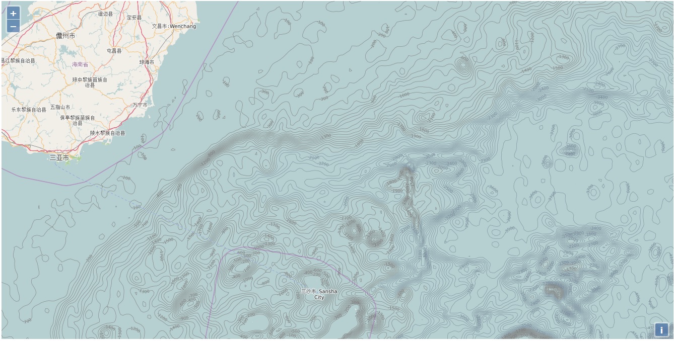
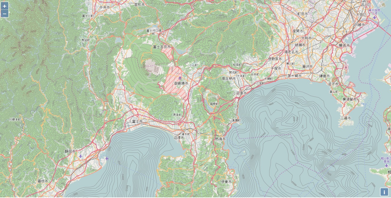
重新渲染后,效果还不错!虽然1角分的分辨率比较低,但是在海洋上还是够用啦!
相关数据与虚拟机镜像在这里下载。
网站测试:
http://www.goldenhawking.org:8088/
转载自:https://blog.csdn.net/goldenhawking/article/details/69647193

