geoserver 架构
The GeoServer Project – the open Internet gateway for geographic data Packages
org.vfny.geoserver
Contains all interface servlets, one for each WFS response.
org.vfny.geoserver.action
Control of the GeoServer application (Struts Actions).
org.vfny.geoserver.action.data
Contains Actions for configuring the GeoServer Data Model.
org.vfny.geoserver.action.global
org.vfny.geoserver.action.validation
org.vfny.geoserver.action.wfs
Contains Actions for configuring the GeoServer Web Feature Server.
org.vfny.geoserver.action.wms
Contains Actions for configuring the GeoServer Web Map Server.
org.vfny.geoserver.config
Configuration Model being edited.
org.vfny.geoserver.config.validation
Validation Model being edited.
org.vfny.geoserver.form
Java Beans used to represent input screens (STRUTS Form Beans).
org.vfny.geoserver.form.data
Contains Form Beans describing the GeoServer Data Model.
org.vfny.geoserver.form.global
org.vfny.geoserver.form.validation
org.vfny.geoserver.form.wfs
Contains Web Feature Server Form Beans.
org.vfny.geoserver.form.wms
Contains Web Map Server Form Beans.
org.vfny.geoserver.global
Maintains the GeoServer applicaiton state (This is the Application).
org.vfny.geoserver.global.dto
Maintains the Data Transfer Objects used to set up GeoServer.
org.vfny.geoserver.global.xml
Offers XML based persistence to the GeoServer application.
org.vfny.geoserver.servlets
Provides Servlets Framework used by GeoServer.
org.vfny.geoserver.util
Manages all of the top-level responses.
org.vfny.geoserver.util.requests
Handles all of the request processing for GeoServer.
org.vfny.geoserver.util.requests.readers
Client request processing into GeoServer Request objects.
org.vfny.geoserver.wfs
org.vfny.geoserver.wfs.requests
Handles all of the WFS request processing for GeoServer.
org.vfny.geoserver.wfs.requests.readers
WFS Client request processing into Request objects for the GeoServer framework.
org.vfny.geoserver.wfs.responses
Manages all of the top-level WFS responses.
org.vfny.geoserver.wfs.servlets
Provides Servlets for the GeoServer Web Feature Server implementation.
org.vfny.geoserver.wms
org.vfny.geoserver.wms.requests
Handles all of the request processing for the WMS interfaces.
org.vfny.geoserver.wms.responses
Manages all of the top-level WMS responses.
org.vfny.geoserver.wms.responses.featureInfo
org.vfny.geoserver.wms.responses.helpers
org.vfny.geoserver.wms.responses.map
Manages all of the WMS Map responses.
org.vfny.geoserver.wms.responses.map.gif
org.vfny.geoserver.wms.responses.map.kml
org.vfny.geoserver.wms.responses.map.png
org.vfny.geoserver.wms.responses.map.svg
org.vfny.geoserver.wms.servlets
Provides Servlets for the GeoServer Web Map Server implementation.
org.vfny.geoserver.zserver
Provides a ZServer Catalog Service for GeoServer.
The GeoServer Project – the open Internet gateway for geographic data
The GeoServer Project is a Java (J2EE) implementation of:
The OpenGIS Consortium’s Web Feature Server specification. With full transactional support!
The OpenGIS Consortium’s Web Map Server Specification.
ZServer
GeoServer is free software, available under the GPL 2.0 license.
Users
who would like to access and modify their geographic data over the
Internet using flexible, industry-approved standards should take a look
at GeoServer.
GeoServer Design
GeoServer is constructed
using a Layered Design as outlined in the diagram below. There are two
Layer systems in use – the classic J2EE
Servlet/Handler/Request/Response and the STRUTS Framework.
GeoServer Layer Diagram
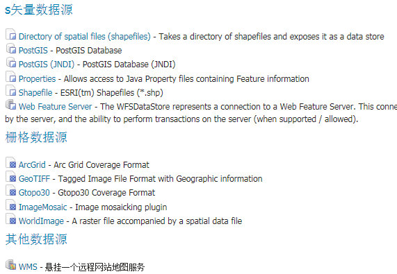
Use of GeoTools2
As
seen in the above Layer Diagram GeoServer makes use of the wonderful
GeoTools2 library to provide data access. GeoServer maintains its own
geotools.jar available in the lib directory. This jar is often more
recent then the latest GeoTools public beta.
Many GeoServer
classes implement GeoTools2 interfaces inorder to facilitate reuse and
intergration with subsystems such as validation.
2 GeoServer架构
(此部分内容转载,转载自http://geoserver.org/display/GEOSDOC/1+GeoServer+Architecture
)
The
following diagram provides an Overview of the GeoServer architecture.
The GeoServer application is comprised of a series of modules.
GeoServer modules can be combined with our maven 2 build sytem to form
a deployable war.
At runtime a module can make use of
Spring to obtain classes providing services from other modules. This
ability to “plug-in” additional functionality forms the basis for
GeoServers extension mechanism. This mechanism is used to provide
additional OGC web services (by the WFS and WMS modules) and to
implement support for different WMS image encodings.
The core
geoserver modules serve as a useful example of how new services can be
added. You can review the web module for an example of packaging
modules into a deployable war.
转载自:https://blog.csdn.net/hupy2007/article/details/83495196