GeoServer-WMS,WFS,WCS
目录
GeoServer-WMS,WFS,WCS
2016年8月23日重构
2016年10月17日添加jsonp操作
1 方法:发布WMS
1.1 目标:WMS(OpenGIS Web Map Service),将地图数据发布为WEB服务,提供网络地图图片。
功能包括:GetCapabilities,GetMap,GetFeatureInfo,GetLegendGraphic。
1.2 发布:图层上设置发布信息,保存后就可以发布了。
1.3 测试:使用QGIS测试
1.3.1获取WMS地址
1.3.1.1 获取WMS地址:http://服务器IP:PORT/geoserver[/工作空间[/图层名]]/wms
如果可选部分不使用的话,将获取其下所有的服务。
1.3.1.2 或从WMS的文档中获取:在OnlineReference中获取。
1.3.1.3 或在LayerPreview中选择需要服务:
从中获取服务地址,只需要到WMS就可以,http://localhost:8080/geoserver/testShp/wms
1.3.2在Qgis加载WMS服务:设置连接参数
将WMS地址输入,设置名字,就可以查看当前工作区中所有WMS服务。选择需要的图层,加入到Qgis中进行显示。
1.4 示例:
WMS GetMap:
WMS GetFeatureInfo:
返回值:
|
<html> |
|
<head> |
|
<title>Geoserver GetFeatureInfo output</title> |
|
</head> |
|
<style type=”text/css”> |
|
table.featureInfo, table.featureInfo td, table.featureInfo th { |
|
border:1px solid #ddd; |
|
border-collapse:collapse; |
|
margin:0; |
|
padding:0; |
|
font-size: 90%; |
|
padding:.2em .1em; |
|
} |
|
table.featureInfo th { |
|
padding:.2em .2em; |
|
font-weight:bold; |
|
background:#eee; |
|
} |
|
table.featureInfo td{ |
|
background:#fff; |
|
} |
|
table.featureInfo tr.odd td{ |
|
background:#eee; |
|
} |
|
table.featureInfo caption{ |
|
text-align:left; |
|
font-size:100%; |
|
font-weight:bold; |
|
padding:.2em .2em; |
|
} |
|
</style> |
|
<body> |
|
<table class=”featureInfo”> |
|
<caption class=”featureInfo”>states</caption> |
|
<tr> |
|
<th>fid</th> |
|
<th >STATE_NAME</th> |
|
<th >STATE_FIPS</th> |
|
<th >SUB_REGION</th> |
|
<th >STATE_ABBR</th> |
|
<th >LAND_KM</th> |
|
<th >WATER_KM</th> |
|
<th >PERSONS</th> |
|
<th >FAMILIES</th> |
|
<th >HOUSHOLD</th> |
|
<th >MALE</th> |
|
<th >FEMALE</th> |
|
<th >WORKERS</th> |
|
<th >DRVALONE</th> |
|
<th >CARPOOL</th> |
|
<th >PUBTRANS</th> |
|
<th >EMPLOYED</th> |
|
<th >UNEMPLOY</th> |
|
<th >SERVICE</th> |
|
<th >MANUAL</th> |
|
<th >P_MALE</th> |
|
<th >P_FEMALE</th> |
|
<th >SAMP_POP</th> |
|
</tr> |
|
<tr> |
|
<td>states.36</td> |
|
<td>Iowa</td> |
|
<td>19</td> |
|
<td>W N Cen</td> |
|
<td>IA</td> |
|
<td>144715.989</td> |
|
<td>1037.659</td> |
|
<td>2776755.0</td> |
|
<td>740819.0</td> |
|
<td>1064325.0</td> |
|
<td>1344802.0</td> |
|
<td>1431953.0</td> |
|
<td>1013757.0</td> |
|
<td>970933.0</td> |
|
<td>156930.0</td> |
|
<td>16373.0</td> |
|
<td>1340242.0</td> |
|
<td>63641.0</td> |
|
<td>429860.0</td> |
|
<td>217271.0</td> |
|
<td>0.484</td> |
|
<td>0.516</td> |
|
<td>579075.0</td> |
|
</tr> |
|
</table> |
|
<br/> |
|
</body> |
|
</html> |
参考:http://blog.csdn.net/chenxiaodan_danny/article/details/42675411
2方法:发布WFS
2.1 目标:WFS(Web Feature Service)目的是提供对矢量地图的查询、编译等操作。
功能包含:GetCapabilities,DescribeFeatureType,GetFeature(查询),LockFeature(加锁,用于事务),Transaction(编辑事务)。
2.2 发布:将工作区设置为WFS启用,然后在Layer中设置发布属性。
参考:http://girona-geoserver-workshop.readthedocs.org/en/latest/overview/wfs.html
https://wiki.state.ma.us/confluence/display/massgis/GeoServer+-+WFS+-+Extract+-+Shapefile+Format
2.2.1启用jsonp输出格式:默认是禁止的。
参考:
http://gis.stackexchange.com/questions/57494/geoserver-2-3-how-to-enable-jsonp
在web.xml中去掉jsonp的注释。
jsonp将返回parseResponse()函数调用。
示例:参见:leaflet.docx《Identify地图元素信息:JSONP跨域操作》部分。
2.3 测试:QGIS加载WFS,并执行编辑。
2.3.1获取WFS地址:与WMS相似
2.3.1.1 获取WMS地址:http://服务器IP:PORT/geoserver[/工作空间[/图层名]]/WFS
2.3.1.2 或从WMS的文档中获取:在Operation中获取Url,但这样获取的是所有的WFS。
2.3.1.3 或在LayerPreview中选择需要服务,从中获取xsi:schemaLocation中找到wfs地址。
2.3.2在Qgis加载WFS服务:设置连接参数,添加图层。
WFS可以进行图层编辑
2.4 示例:
返回值:
This XML file doesnot appear to have any style information associated with it. The document treeis shown below.
<wfs:FeatureCollection xmlns=”http://www.opengis.net/wfs” xmlns:wfs=”http://www.opengis.net/wfs” xmlns:testShp=”localhost:8080/testShp” xmlns:gml=”http://www.opengis.net/gml”xmlns:xsi=”http://www.w3.org/2001/XMLSchema-instance” xsi:schemaLocation=”http://www.opengis.net/wfshttp://localhost:8080/geoserver/schemas/wfs/1.0.0/WFS-basic.xsdlocalhost:8080/testShphttp://localhost:8080/geoserver/wfs?service=WFS&version=1.0.0&request=DescribeFeatureType&typeName=testShp%3Astates”>
<gml:boundedBy>
<gml:null>unknown</gml:null>
</gml:boundedBy>
<gml:featureMember>
<testShp:states fid=”states.2″>
<testShp:the_geom>
<gml:MultiPolygon srsName=”http://www.opengis.net/gml/srs/epsg.xml#4326″>
<gml:polygonMember>
<gml:Polygon>
<gml:outerBoundaryIs>
<gml:LinearRing>
<gml:coordinates xmlns:gml=”http://www.opengis.net/gml” decimal=”.” cs=”,” ts=” “>
-77.008232,38.966557-76.911209,38.889988 -77.045448,38.78812 -77.035248,38.813915-77.045189,38.829365 -77.040405,38.838413 -77.039078,38.862431-77.067886,38.886101 -77.078949,38.9156 -77.122627,38.93206-77.042389,38.993431 -77.008232,38.966557
</gml:coordinates>
</gml:LinearRing>
</gml:outerBoundaryIs>
</gml:Polygon>
</gml:polygonMember>
</gml:MultiPolygon>
</testShp:the_geom>
<testShp:STATE_NAME>Districtof Columbia</testShp:STATE_NAME>
<testShp:STATE_FIPS>11</testShp:STATE_FIPS>
<testShp:SUB_REGION>SAtl</testShp:SUB_REGION>
<testShp:STATE_ABBR>DC</testShp:STATE_ABBR>
<testShp:LAND_KM>159.055</testShp:LAND_KM>
<testShp:WATER_KM>17.991</testShp:WATER_KM>
<testShp:PERSONS>606900.0</testShp:PERSONS>
<testShp:FAMILIES>122087.0</testShp:FAMILIES>
<testShp:HOUSHOLD>249634.0</testShp:HOUSHOLD>
<testShp:MALE>282970.0</testShp:MALE>
<testShp:FEMALE>323930.0</testShp:FEMALE>
<testShp:WORKERS>229975.0</testShp:WORKERS>
<testShp:DRVALONE>106694.0</testShp:DRVALONE>
<testShp:CARPOOL>36621.0</testShp:CARPOOL>
<testShp:PUBTRANS>111422.0</testShp:PUBTRANS>
<testShp:EMPLOYED>303994.0</testShp:EMPLOYED>
<testShp:UNEMPLOY>23442.0</testShp:UNEMPLOY>
<testShp:SERVICE>65498.0</testShp:SERVICE>
<testShp:MANUAL>22407.0</testShp:MANUAL>
<testShp:P_MALE>0.466</testShp:P_MALE>
<testShp:P_FEMALE>0.534</testShp:P_FEMALE>
<testShp:SAMP_POP>72696.0</testShp:SAMP_POP>
</testShp:states>
</gml:featureMember>
</wfs:FeatureCollection>
3方法:发布WCS
3.1 目标:WCS(Web Coverage Service),目标是发布原始栅格数据。
功能包括GetCapabilities,GetCoverage,DescribeCoverage。
3.2 发布:工作空间启用WCS并设置图层的发布属性。
3.3 测试:QGIS加载WCS
3.3.1获取WMS地址
3.3.1.1 获取WMS地址:http://服务器IP:PORT/geoserver[/工作空间[/图层名]]/WCS
3.3.1.2 或从WMS的文档中获取:在Operation中获取Url,但这样获取的是所有的WCS。
3.3.1.3 或演示中获取地址
3.3.2QGIS中加载WCS
WCS图片加载完成后,可能会有空白的地方,这是因为默认将0值设置为无值像素。
在图层属性中将无值像素去掉,可以正常显示。
3.4 测试:使用演示-》WCS Request Builder可以生成请求POST的XML和测试。
参考:
示例:
GetCoverage则下载图像。
点击Generate就可以生成XML。
<?xmlversion=”1.0″ encoding=”UTF-8″?>
<GetCoverageversion=”1.0.0″ service=”WCS”xmlns:xsi=”http://www.w3.org/2001/XMLSchema-instance”xmlns=”http://www.opengis.net/wcs” xmlns:ows=”http://www.opengis.net/ows/1.1″xmlns:gml=”http://www.opengis.net/gml”xmlns:ogc=”http://www.opengis.net/ogc”xsi:schemaLocation=”http://www.opengis.net/wcshttp://schemas.opengis.net/wcs/1.0.0/getCoverage.xsd”>
<sourceCoverage>nurc:Img_Sample</sourceCoverage>
<domainSubset>
<spatialSubset>
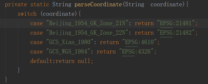
<gml:EnvelopesrsName=”EPSG:4326″>
<gml:pos>-130.8516820.7052</gml:pos>
<gml:pos>-62.005454.1141</gml:pos>
</gml:Envelope>
<gml:Grid dimension=”2″>
<gml:limits>
<gml:GridEnvelope>
<gml:low>0 0</gml:low>
<gml:high>983597</gml:high>
</gml:GridEnvelope>
</gml:limits>
<gml:axisName>x</gml:axisName>
<gml:axisName>y</gml:axisName>
</gml:Grid>
</spatialSubset>
</domainSubset>
<output>
<crs>EPSG:4326</crs>
<format>GeoTIFF</format>
</output>
</GetCoverage>
转载自:https://blog.csdn.net/sf2gis2/article/details/52854030