An intuition for photogrammetry
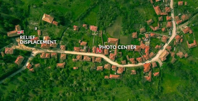
If you take a single aerial photo, there’s a center point in the photo where it’s looking straight down. At this center point, you can’t see any of the sides of the building or features.
But if you look somewhere else in the image, you’ll see that features like buildings are leaning over in the photo. This radial displacement from the center point is known as relief displacement.
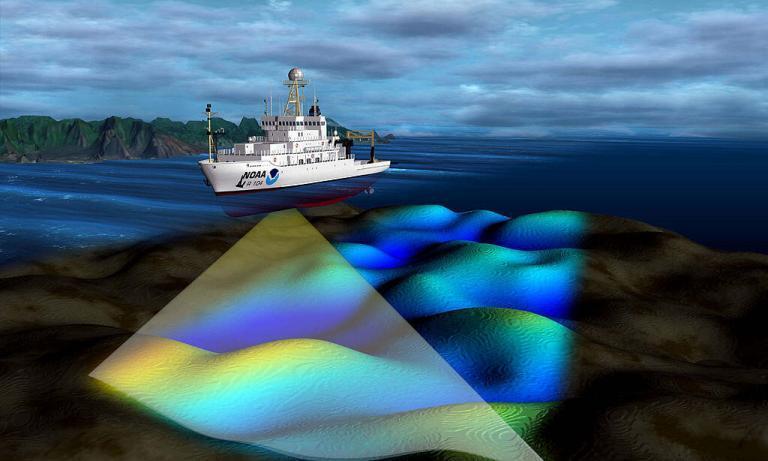
“Photogrammetry uses photographs from at least two different vantage points. Similar to how your eyes work, it obtains depth and perspective because of separate points of observation.”
Relief Displacement vs Parallax
RELIEF DISPLACEMENT: Relief displacement occurs when buildings, mountains, or hilltops are displaced from the central projection of an aerial photograph due to relief. The further objects are away from the center of the image, the more relief displacement occurs for a feature.
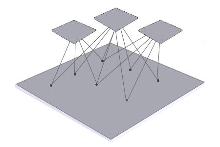
The goal of photogrammetry is to correct relief displacement in an image through overlapping stereo images. This is why planes zigzag over the same area similar to how a lawnmower cuts the grass. The multiple camera angles create the necessary overlap and parallax.
PARALLAX: Stereographic parallax is the apparent shift in relative positions of features when it is viewed in different locations. This is different from relief displacement because it takes point observations from the same object in separate photographs.
You only get stereographic parallax when you get two or more vantage points of the same object. Then, if you view the feature from different points of observation, you can measure relief displacement.
Steps to Create a Photogrammetric Model
Creating a photogrammetric model requires the following:
- TIE POINTS: Tie points link coordinates from two or more overlapping images. In general, you assign tie points for features that are visually apparent in two or more photographs. When you have overlap, tie points adjust photos together through common feature coordinates.
- GROUND CONTROL POINTS (GCP): Establishing ground control orientates and positions images to known geographic coordinates on Earth’s surface. By adding ground control points, you give photogrammetric products a spatial reference to the real world.
- BUNDLE ADJUSTMENT: Running a block bundle adjustment removes geometric distortion from a set of images of three-dimensional points at different viewpoints. This process minimizes the error between observed and predicted image points during reprojection.
Tie points link your images together. Ground control points give reference to the real world. And bundle adjustments put it all together minimizing error.
Products Derived From Photogrammetry
After you run a bundle adjustment, you can generate several photogrammetric products:
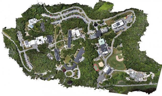
ORTHOMOSAIC: Orthomosaics correct geometric distortion that’s inherent in imagery. By using the assigned tie points and GCPs, it can reference images to the real world. The final product is a seamless mosaic stitched through edge matching and color balancing.
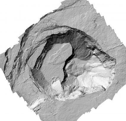
DIGITAL SURFACE MODEL: A digital surface model (DSM) captures the natural and built features on the Earth’s surface by including their height. For example, height can come from the top of buildings, tree canopy, and powerlines.
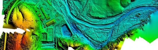
DIGITAL TERRAIN MODEL: A digital terrain model (DTM) is simply an elevation surface representing the bare earth. When you take away all the features on Earth, this is what a DTM represents. Depending on where you live, a DTM is synonymous with a Digital Elevation Model (DEM). For example, ASTER GDEM uses stereo pairs from two images at different angles and is an example of a photogrammetric DEM.
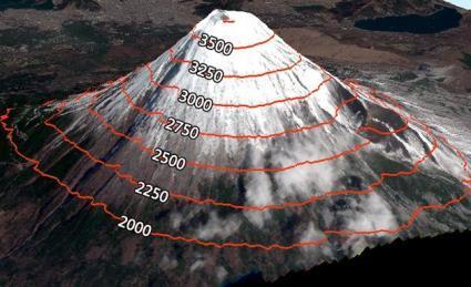
CONTOURS: Contours are lines of equal elevation and are a by-product of a digital terrain model. They are useful for showing the steepness of slopes, cliffs, ridges, and valleys.
Photogrammetry Software
PIX4D: Pix4D is a very popular choice for photogrammetry software because it’s easy to use and has a large user base. For any type of drone, satellite, scans, or airplane overlapping imagery, Pix4D gives you a solid foundation in photogrammetry tools.
ESRI ORTHOMAPPING: Esri’s ortho mapping has come a long way since it was first introduced. It delivers a set of tools in ArcGIS Pro to add tie points, GCPs, and checkpoints to an ortho mapping workspace. It allows you to adjust, mosaic, edge match, and color balance any of your ortho mapping products.
E-FOTO: The core functionality of E-foto is photo triangulation, stereoscopic modeling, and terrain correction. This software provides a fully functional set of photogrammetry tools to use at no cost. E-foto has loads of tutorials and examples to get you well on your way to being a photogrammetry expert.