
Openlayers之聚合标注
1、聚合标注
聚合标注是指在不同的地图分辨率下,通过聚合的方式来展示标注点的一种方法,其目的就是为了减少当前视窗中加载的标注点的数量,从而提高客户端的渲染速度,有点类似于ArcGIS的点抽稀。
2、代码实现
<!DOCTYPE html>
<html xmlns="http://www.w3.org/1999/xhtml">
<head>
<meta http-equiv="Content-Type" content="text/html; charset=utf-8"/>
    <title></title>
    <script src="../lib/ol/ol.js"></script>
    <script type="text/javascript">
        window.onload = function () {
            //初始化地图
            var map = new ol.Map({
                target: 'map',
                layers: [
                    new ol.layer.Tile({
                        source: new ol.source.OSM()
                    })
                ],
                view: new ol.View({
                    center: new ol.proj.fromLonLat([116.28, 39.54]),
                    zoom: 8
                })
            });

            //创建要素的数量
            //10000个点没有任何压力,50000个点稍微有些卡了,100000个点可以把浏览器卡崩溃
            var count = 10000;
            //创建一个要素数组
            var features = new Array(count);
            //坐标偏移量
            var e = 8500000;

            for (var i = 0; i < count; i++) {
                //要素坐标
                var coordinates = [3 * e * Math.random() - e, 2 * e * Math.random() - e];
                //新建点要素
                features[i] = new ol.Feature(new ol.geom.Point(coordinates));
            }

            //初始化矢量数据源
            var source = new ol.source.Vector({
                //要素
                features:features
            });

            //初始化聚合标注数据源
            var clusterSource = new ol.source.Cluster({
                //标注元素之间的间距
                distance: 40,
                //数据源
                source:source
            });

            //样式缓存
            var styleCache = {};
            //初始化矢量图层
            var clusters = new ol.layer.Vector({
                //数据源
                source: clusterSource,
                //样式
                style: function (feature, resolution) {
                    //当前聚合标注数据源的要素大小
                    var size = feature.get('features').length;
                    //定义样式
                    var style = styleCache[size];
                    //如果当前样式不存在则创建
                    if (!style) {
                        style = [
                            //初始化样式
                            new ol.style.Style({
                                //点样式
                                image: new ol.style.Circle({
                                    //点的半径
                                    radius: 10,
                                    //笔触
                                    stroke: new ol.style.Stroke({
                                        color: '#fff'
                                    }),
                                    //填充
                                    fill: new ol.style.Fill({
                                        color: '#3399cc'
                                    })
                                }),
                                //文本样式
                                text: new ol.style.Text({
                                    //文本内容
                                    text: size.toString(),
                                    //填充
                                    fill: new ol.style.Fill({
                                        color: '#fff'
                                    })
                                })
                            })
                        ];
                        styleCache[size] = style;
                    }
                    return style;
                }
            });
            //将聚合标注图层添加到map中
            map.addLayer(clusters);

            //获取添加聚合标注按钮
            document.getElementById('addFeatures').onclick = function () {
                //获取聚合标注数据源中的要素
                var currentFeatures = clusterSource.getSource().getFeatures();
                //如果当前数据源中没有任何要素则添加
                if (currentFeatures.length == 0) {
                    clusterSource.getSource().addFeatures(features);
                    clusters.setSource(clusterSource);
                    map.addLayer(clusters);
                }
            };

            //获取移除聚合标注的按钮
            document.getElementById('removeFeatures').onclick = function () {
                //清除聚合标注数据源中的所有元素
                clusterSource.getSource().clear();
                //从map中移除聚合标注图层
                map.removeLayer(clusters);
            };
        };
    </script>
</head>
<body>
    <input type="button" name="name" value="添加聚合标签" id="addFeatures" />
    <input type="button" name="name" value="移除聚合标签" id="removeFeatures" />
    <div id="map"></div>
</body>
</html>
3、结果展示
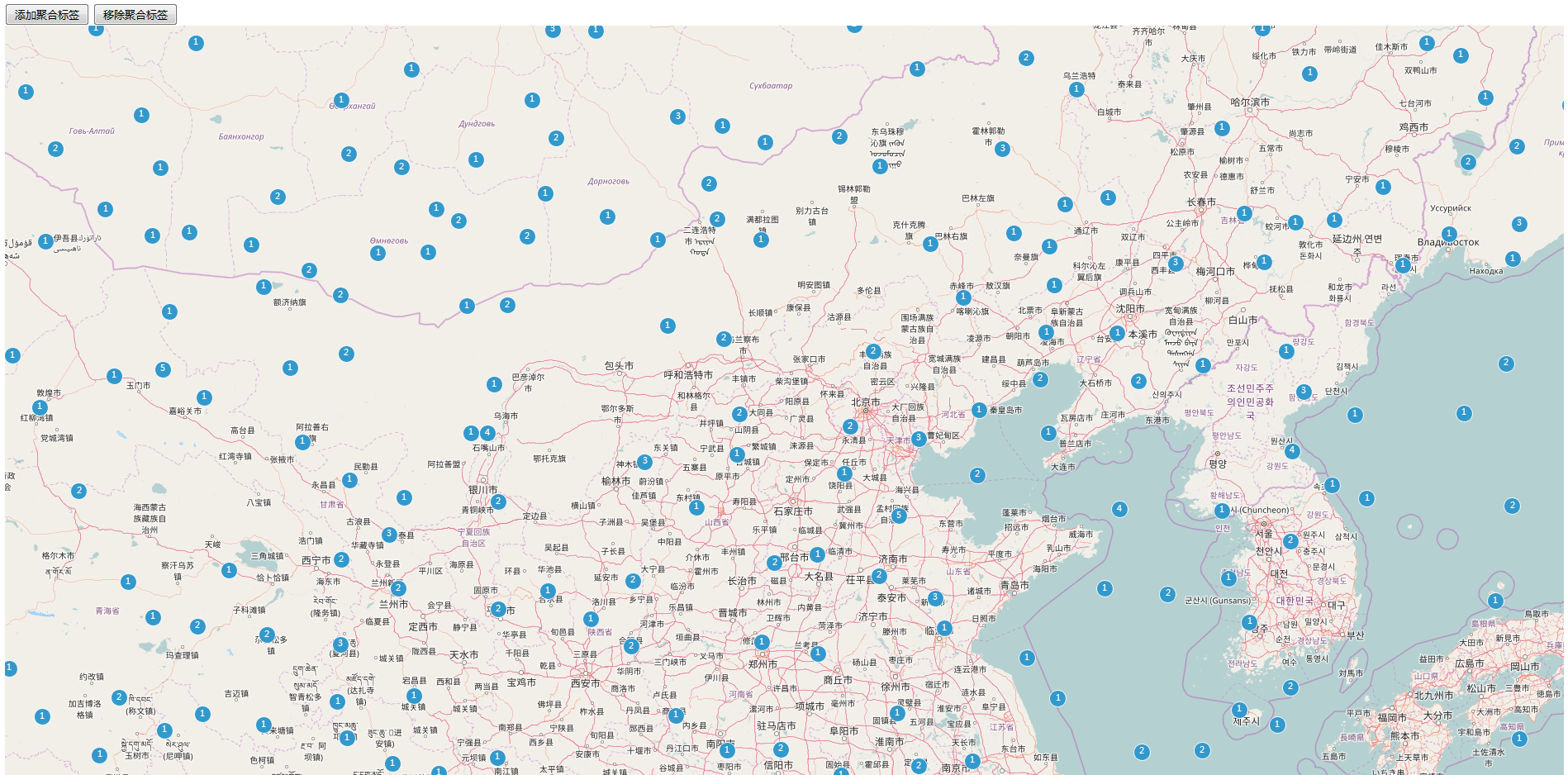
初始化界面

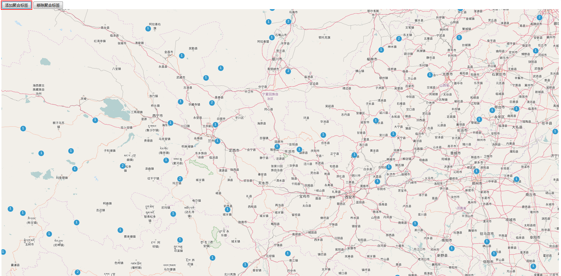
随意更改地图的分辨率(进行缩放操作),标注点的数量也会跟着改变
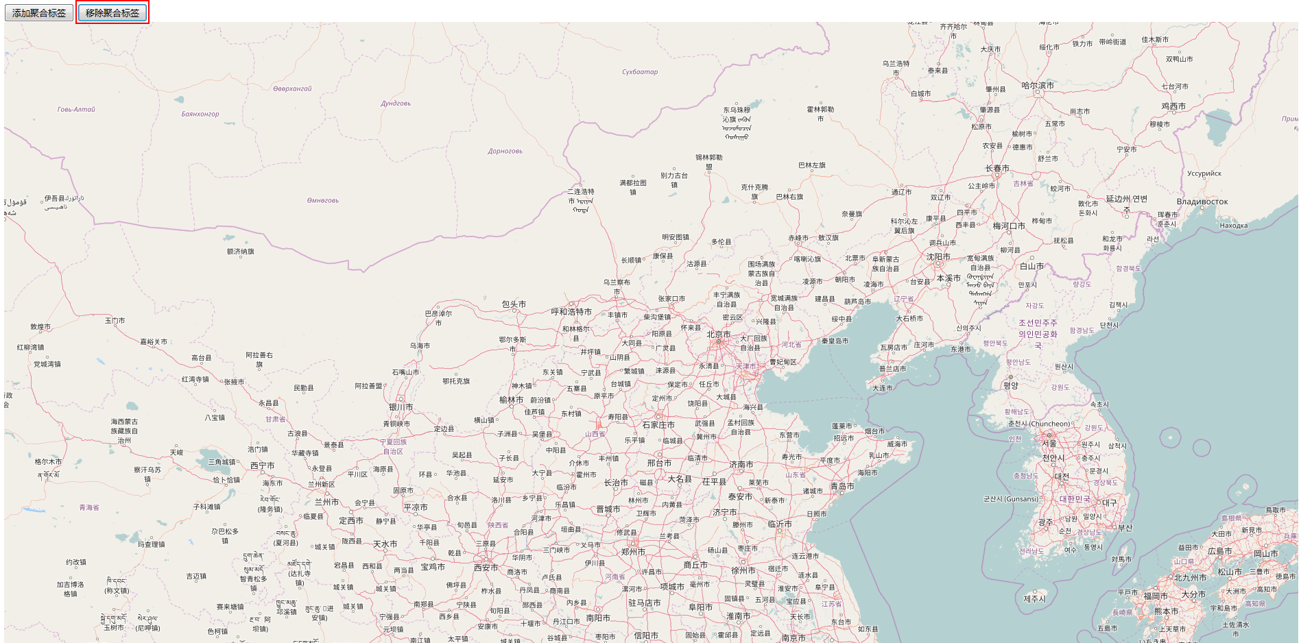
单击左上角的移除聚合标签按钮,则会清空界面上的所有标注
单击左上角的添加聚合标签按钮,则会在界面上重新添加聚合标注
转载自:https://blog.csdn.net/SmileCoffin/article/details/56277185

