Openlayers之拖拽加载矢量数据
1、在日常工作和生活中,我们需要打开某个文件或者加载某些数据的时候,往往通过拖拽的方式来加载或者打开,这样比较直接和方便,那么我们能否使用Openlayers来实现拖拽加载矢量数据呢?答案当然是肯定的,Openlayers为我们提供了一个DragAndDrop的交互式控件,它有一个addfeatures事件,那么我们就可以利用这一点,在把数据拖入地图视口的时候,触发addfeatures事件,从而加载数据,下面我们就来一起实现;
2、代码实现
<!DOCTYPE html>
<html xmlns="http://www.w3.org/1999/xhtml">
<head>
<meta http-equiv="Content-Type" content="text/html; charset=utf-8"/>
    <title></title>
    <link href="../css/ol.css" rel="stylesheet" />
    <script src="../lib/ol/ol.js"></script>
    <script type="text/javascript">
        window.onload = function () {
            //填充样式
            var fill = new ol.style.Fill({
                color: 'rgba(0,0,0,0.2)'
            });

            //笔触
            var stroke = new ol.style.Stroke({
                color: 'rgba(0,0,0,0.4)'
            });

            //点样式
            var circle = new ol.style.Circle({
                radius: 6,
                fill: fill,
                stroke: stroke
            });

            //矢量图层样式
            var vectorStyle = new ol.style.Style({
                fill: fill,
                stroke: stroke,
                image: circle
            });

            //创建一个拖拽交互控件
            var dragAndDrop = new ol.interaction.DragAndDrop({
                //formatConstructors:Array.<function(new:ol.format.Feature)>
                //表示支持哪些可以拖进来的文件格式
                formatConstructors: [
                  ol.format.GPX,
                  ol.format.GeoJSON,
                  ol.format.IGC,
                  ol.format.KML,
                  ol.format.TopoJSON
                ]
            });

            //addfeatures事件:在要素被添加的时候触发
            dragAndDrop.on('addfeatures', function (event) {
                //event是ol.interaction.DragAndDrop.Event事件类型
                //ol.interaction.DragAndDrop.Event成员:
                //features{Array.<ol.Feature>}{undefined} ——The features parsed from dropped data.
                //projection{ol.proj.Projection} {undefined} ——The feature projection.
                //创建矢量数据源
                var vectorSource = new ol.source.Vector({
                    features: event.features,
                    projection: event.projection
                });
                //添加矢量数据图层到map中
                map.addLayer(new ol.layer.Vector({
                    source: vectorSource,
                    style: vectorStyle
                }));
                //获取地图的视图
                var view = map.getView();
                //自适应区域
                view.fit(vectorSource.getExtent(), map.getSize());
            });

            //创建一个OSM瓦片图层
            var layer = new ol.layer.Tile({
                source: new ol.source.OSM()
            });
            //中心点坐标
            var center = ol.proj.transform([0, 0], 'EPSG:4326', 'EPSG:3857');
            //地图视图
            var view = new ol.View({
                center: center,
                zoom: 1
            });
            //创建Map
            var map = new ol.Map({
                target: 'map',
                layers: [layer],
                view: view
            });

            //加载拖拽交互控件到地图中
            map.addInteraction(dragAndDrop);
        };
    </script>
</head>
<body>
    <div id="map"></div>
</body>
</html>
3、结果展示
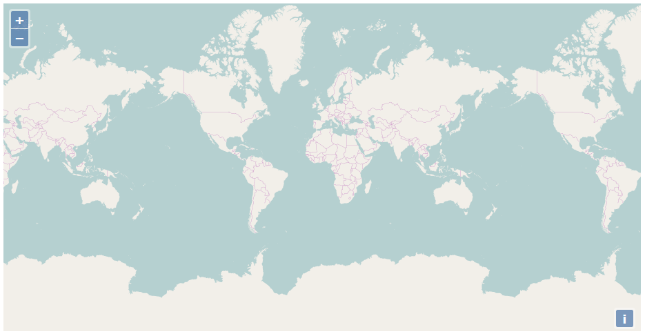
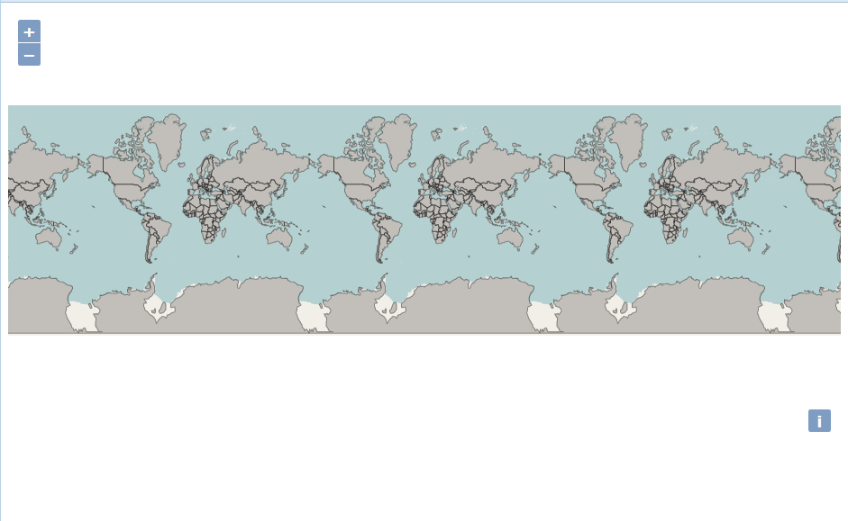
我们先在浏览器中打开该页面:
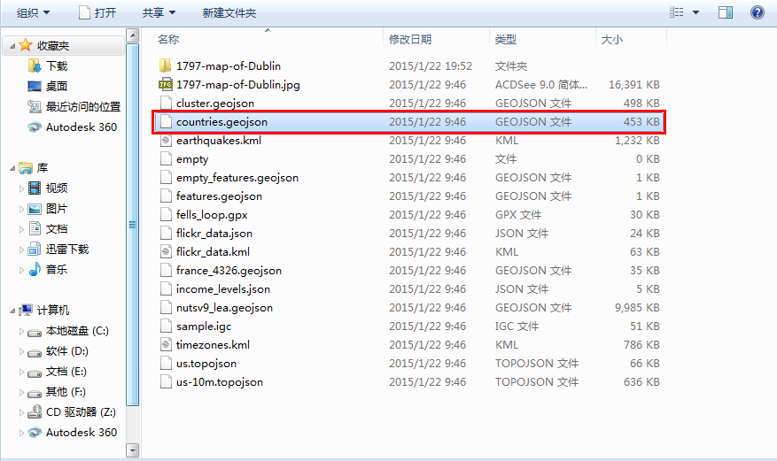
然后找到一个geojson格式的文件:
再将其拖入到地图视口中:
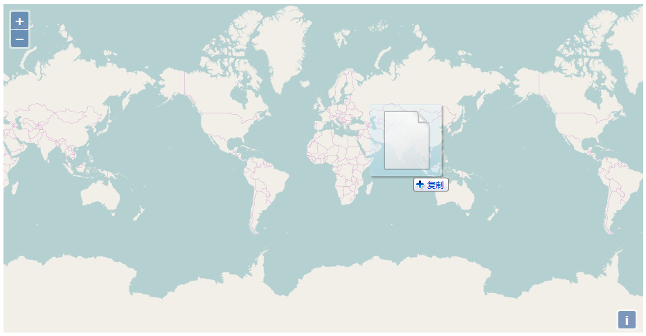
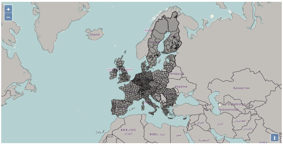
countries.geojson文件立即就被加载到地图中:
我们再用同样的方式加载另一个geojson文件,地图视图会自动跳转到该位置,这就是fit自适应区域的作用:
转载自:https://blog.csdn.net/SmileCoffin/article/details/73292307